Abandoned Interstate 95 Overpass (Georgetown, MA)
Hidden deep within the Georgetown-Rowley State Forest lies an abandoned overpass spanning Interstate 95 — a rusting, graffiti-covered bridge with a fascinating backstory dating to the 1970s.

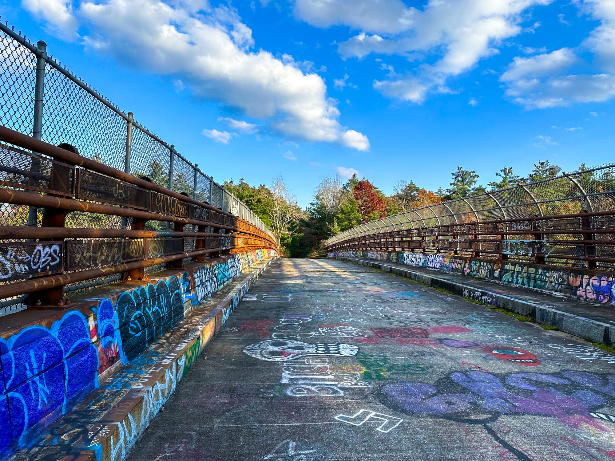
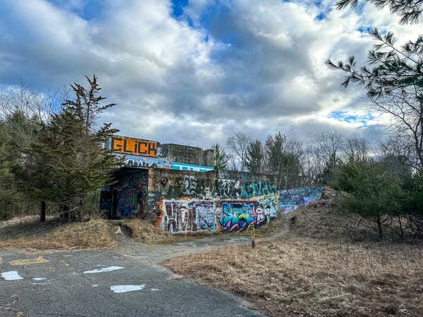
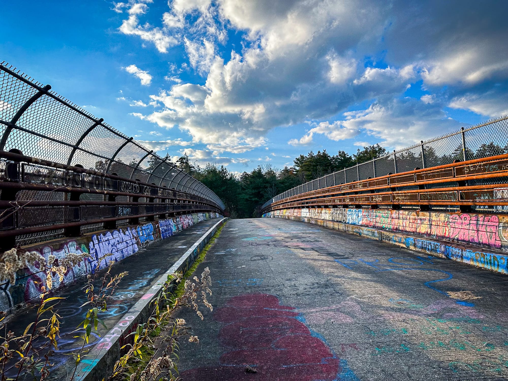
Abandoned I-95 Overpass – Forgotten Bridge in Georgetown, Massachusetts
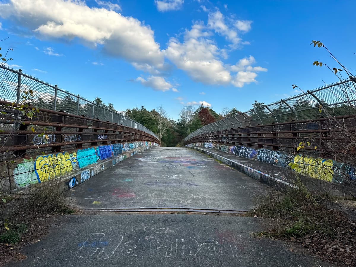
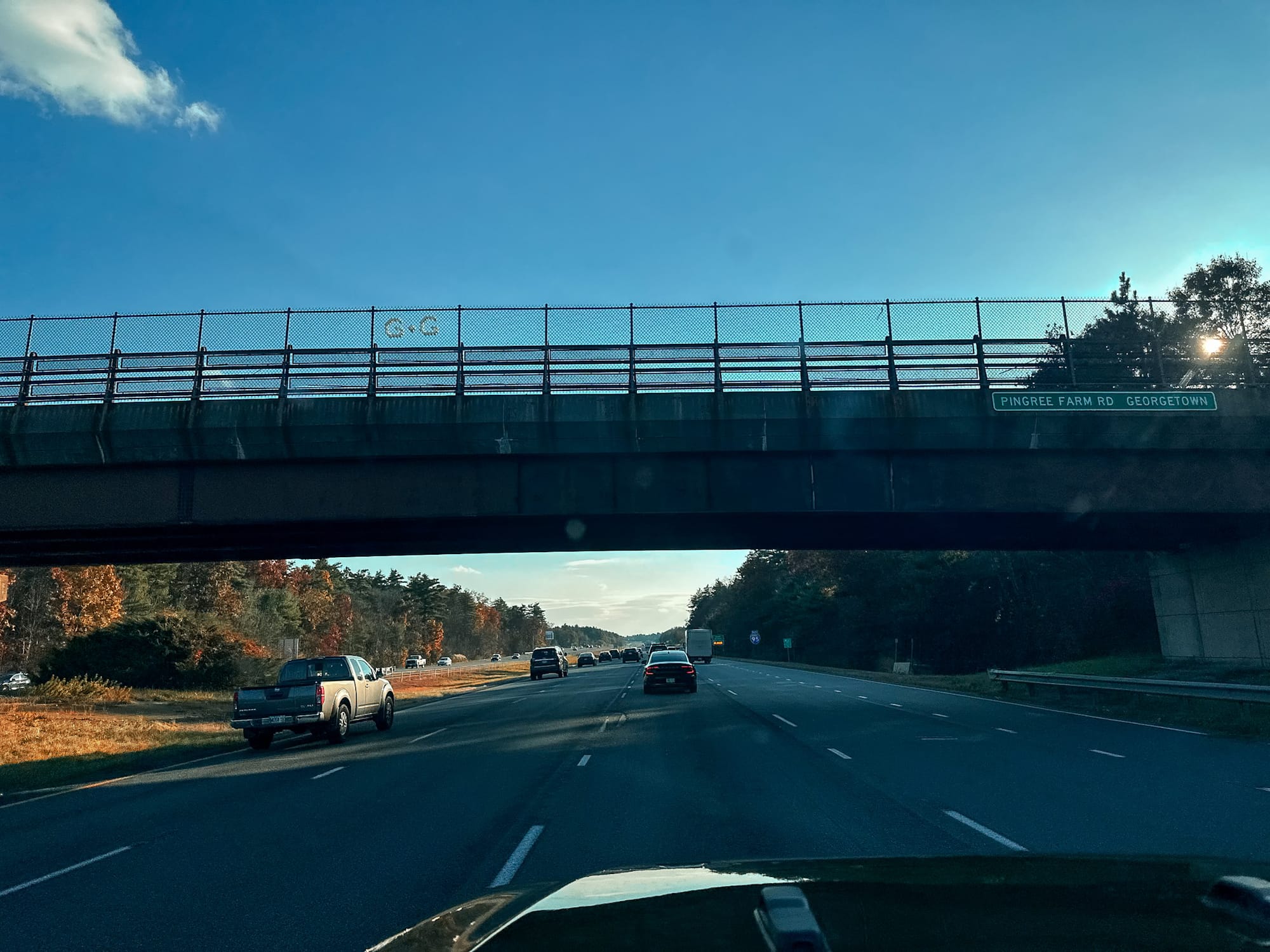
Tens of thousands of people drive under this bridge every single day without realizing that it’s abandoned. Just north of Boston, tucked between the towns of Georgetown and Rowley, a forgotten overpass sits quietly above Interstate 95, its concrete cracked and its steel beams streaked with rust and graffiti.
To most travelers, it looks like any other bridge. But look closer — no cars ever cross it, vegetation creeps along its edges, and its pavement is crumbling into the forest below. This obscure relic has an unexpected and surprisingly practical history that connects two towns, a massive forest, and one of Massachusetts’s busiest highways.

A Brief Background on I-95 in Massachusetts
Interstate 95 (I-95) is one of the most traveled highways in the United States, running from Miami, Florida to Houlton, Maine, tracing nearly the entire East Coast. In Massachusetts alone, I-95 spans 92 miles, making it the third-longest interstate in the state — surpassed only by I-90 and I-495.
At the northern end of this stretch lies Georgetown-Rowley State Forest, a 1,112-acre expanse of protected woodland divided by the highway. And at the center of that divide stands this mysterious abandoned overpass — built not for commuters, but for conservation.
Before the Highway: Farms and Fire Roads
Long before I-95 carved through northeastern Massachusetts, this area was farmland. Records mention the Pingree Farm, which once occupied much of what is now the state forest. The main access route between Georgetown and Rowley was Pingree Farm Road, a quiet country lane that served as the area’s public right-of-way.
In the early 1970s, the expansion of I-95 cut Pingree Farm Road in half. Suddenly, the two sides of the newly designated Georgetown-Rowley State Forest were severed — creating problems for visitors and forest management alike.
The Mystery of the Bridge
Local curiosity has surrounded this overpass for decades. A few persistent rumors tried to explain its existence:
- 🐄 The “Cattle Bridge” Theory: Some believed it was built to let farmers move livestock across the highway. While this sounds plausible given the name Pingree Farm Road, the farms had already vanished long before I-95’s construction.
- 🏘️ The “Planned Neighborhood” Theory: Others thought it was meant to service a proposed residential development with easy access to the interstate. Yet, no ramps or communities were ever built nearby.
Both theories were wrong — but the truth is even more interesting.
The Real Reason: A Bridge for the Forest
When I-95 was extended north in the early 1970s, it split the Georgetown-Rowley State Forest in two, cutting off access to hundreds of acres on the Rowley side. This created serious safety and logistical issues: hikers couldn’t easily move between sections, and emergency vehicles couldn’t reach the eastern half of the forest without a long detour.
In August 1971, an article in the Georgetown Weekly reported that officials were planning a crossing to reconnect the forest — initially proposed as an underpass. After further discussion, the Rowley Conservation Commission recommended an overpass, calling it “imperative” to the forest’s function and encouraging the state to design something “imaginative and beautiful.”
The overpass was completed in 1974, fully equipped with guardrails, fencing, drainage, and a paved roadway. It served not only as a pedestrian and biking path but also as an emergency route for forest rangers and first responders.
For several decades, it worked exactly as intended — a simple, functional bridge quietly linking the two halves of the forest above the roaring interstate.
Decay and Abandonment
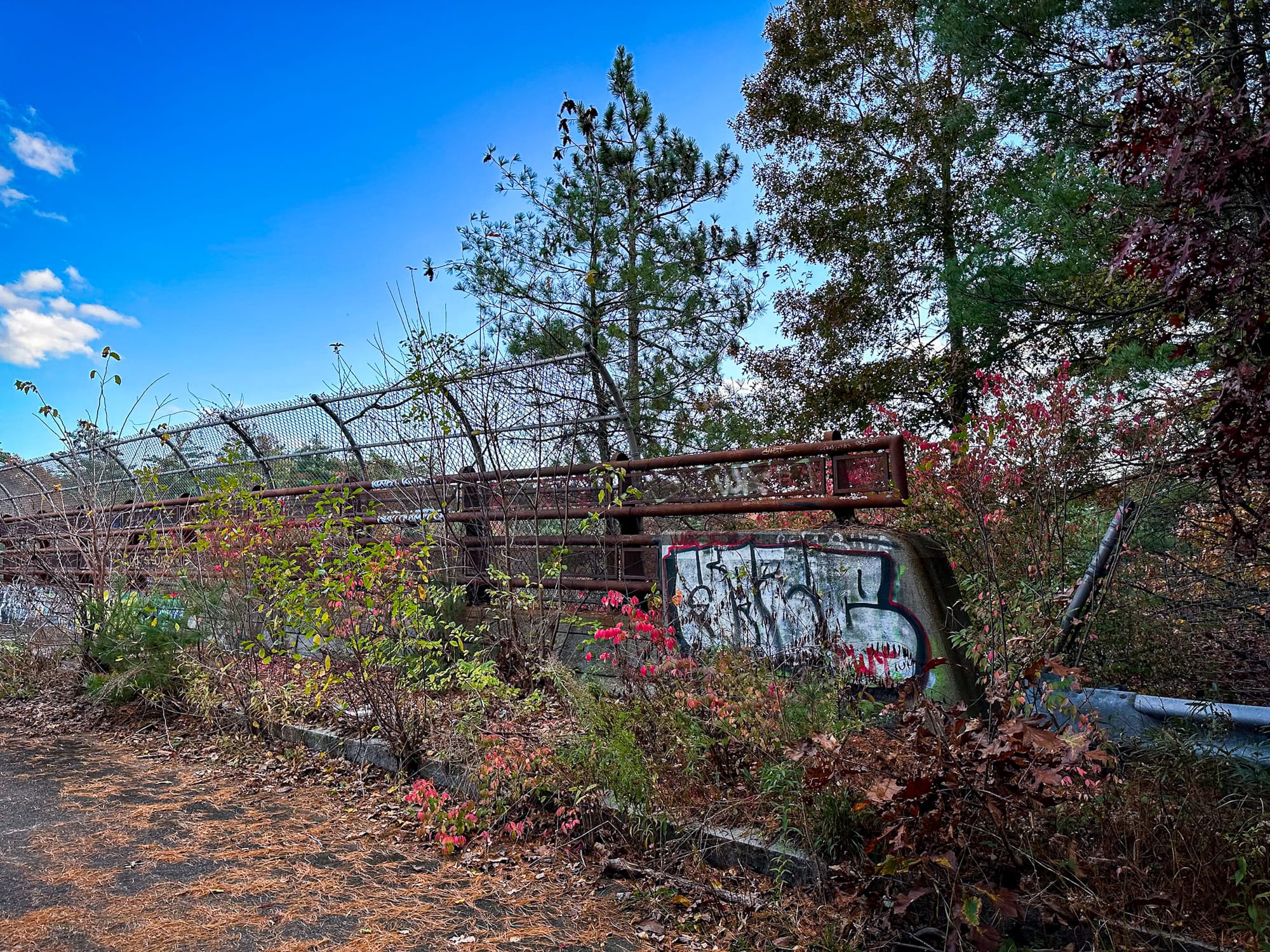
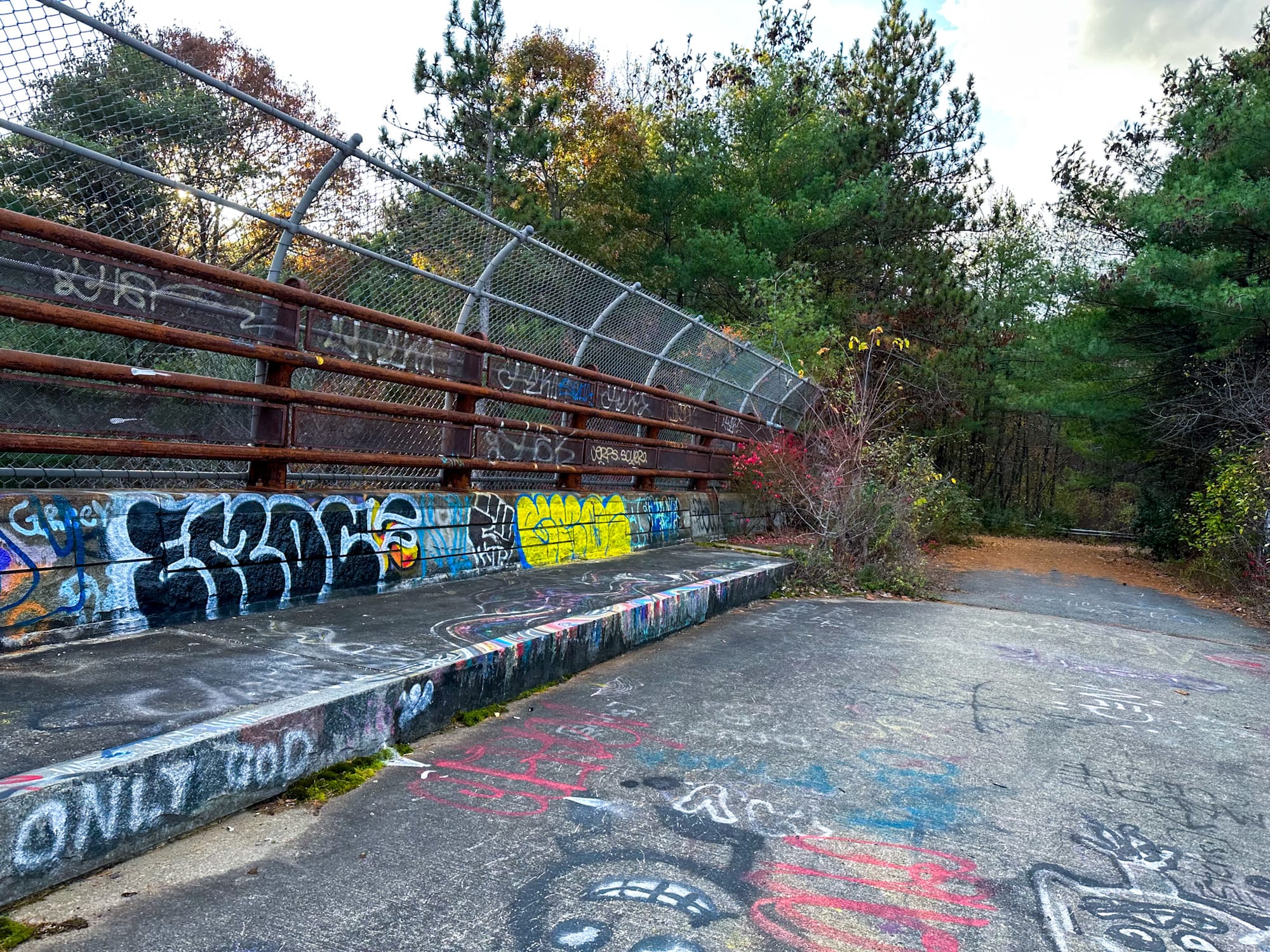
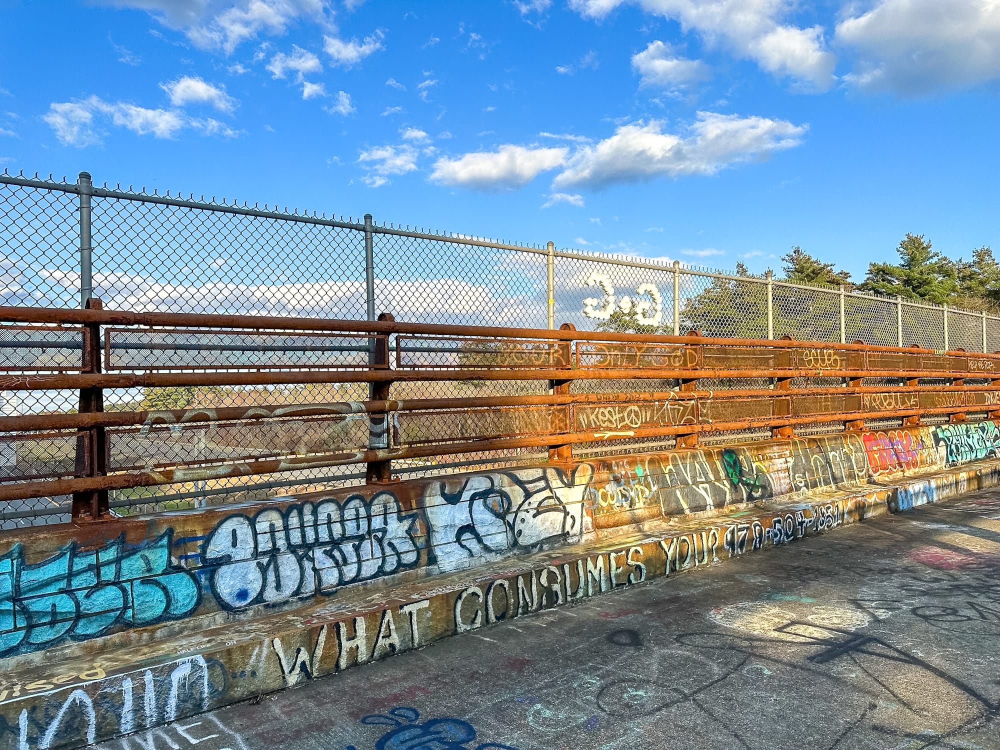
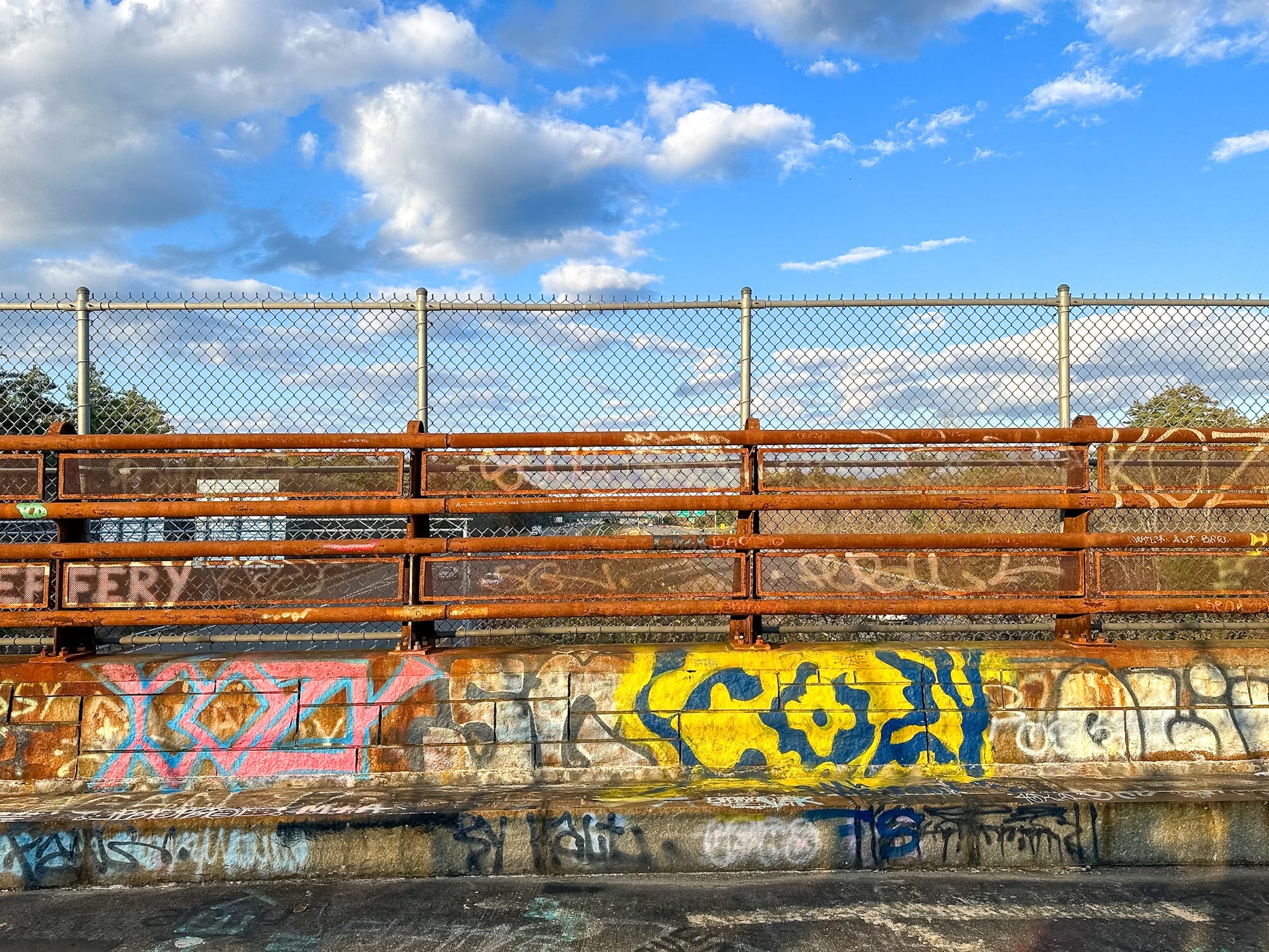
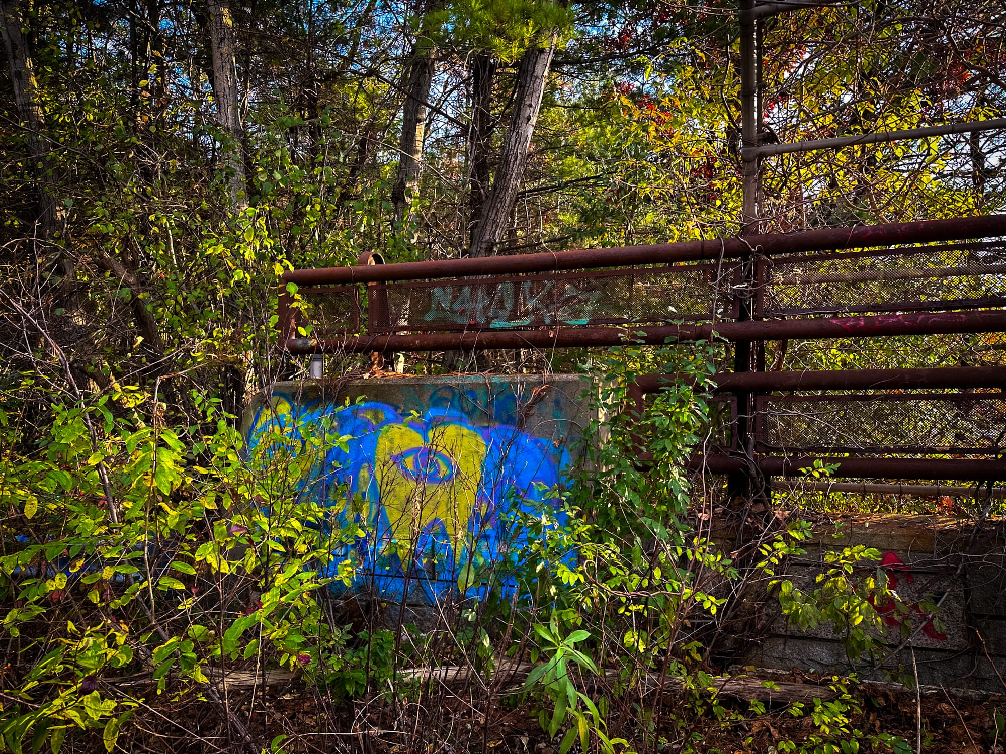
Today, the overpass has fallen into disrepair. Its once-paved surface is cracked and weathered; rust streaks its girders; weeds sprout between the seams. The bridge’s guardrails are tagged with layers of graffiti, and vegetation creeps along its edges.
While it still serves as a footbridge for hikers and bikers, it no longer receives routine maintenance. Whether the Massachusetts Department of Conservation and Recreation plans to restore or demolish it remains uncertain. For now, it stands as an eerie symbol of 1970s engineering — still sturdy, still standing, but slowly succumbing to nature.

Exploring the Overpass Today
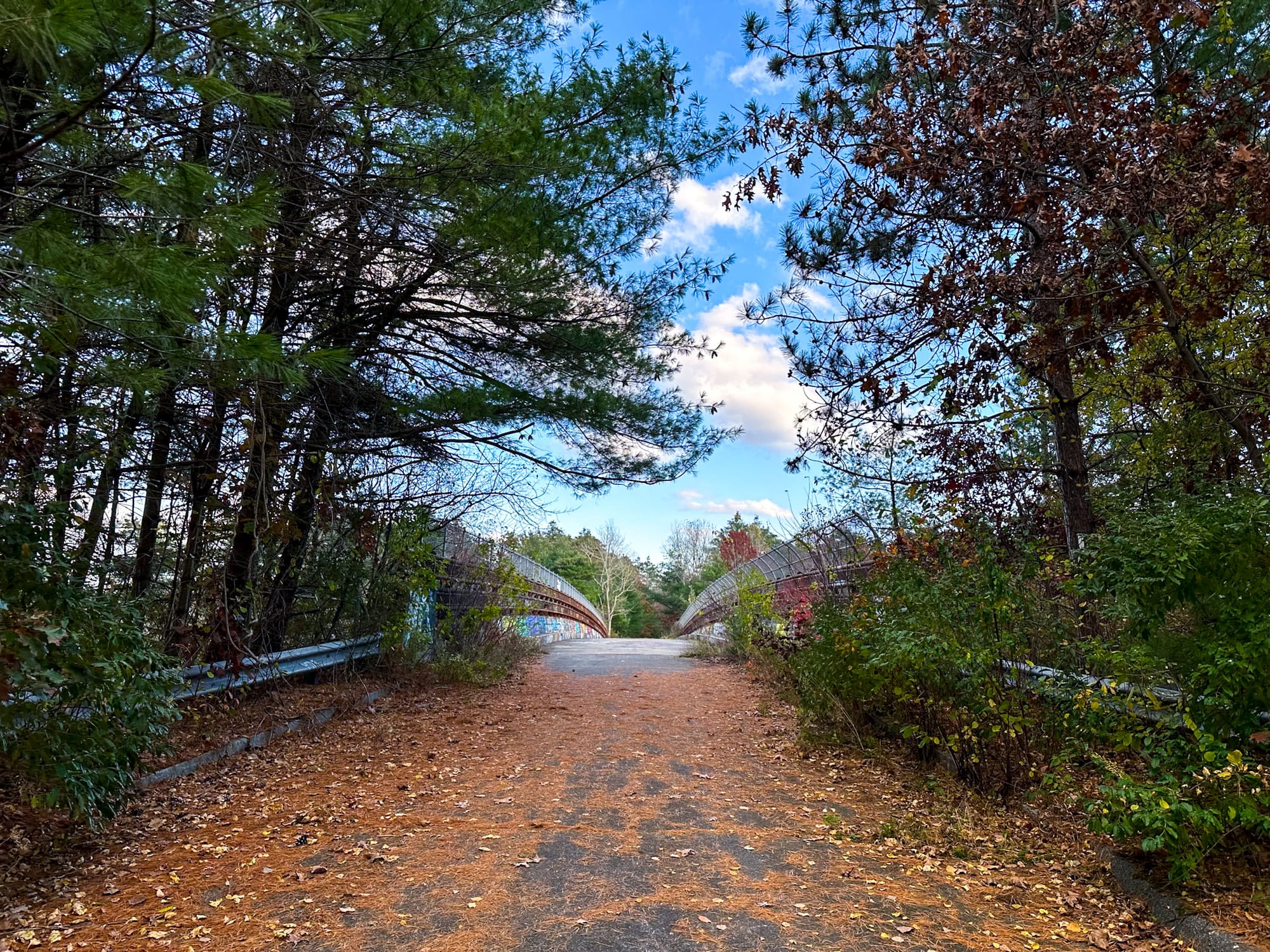
Visiting the abandoned I-95 overpass is easy and makes for a fascinating short hike.
Directions:
- From Georgetown, take Pingree Farm Road until it ends at the Georgetown-Rowley State Forest gate.
- Park in the small dirt lot beside the trailhead — it’s clearly marked with park signage.
- Continue walking or biking down the wide fire road (the old Pingree Farm Road). The pavement ends quickly and turns to dirt.
- After about 0.6 miles (roughly 10 minutes), the road ascends slightly — and the graffiti-covered overpass appears ahead, spanning the highway below.
Standing on the bridge, you can watch cars rush beneath while surrounded by the silence of the forest — a surreal juxtaposition between human infrastructure and nature reclaiming its space.

Visiting Information
- 📍 Address: Pingree Farm Road, Georgetown, Massachusetts
- 🌐 GPS Coordinates: 42.702833, –70.966556
- 🅿️ Parking: Small lot at the Georgetown-Rowley State Forest gate; free parking available
- 🚶 Trail Length: Approx. 1 km (0.6 mi) one-way
- ⏱ Hike Time: 10 minutes
- 🏞 Difficulty: Easy, flat terrain
- 🕰 Hours: Open daily, sunrise to sunset
Quick Facts
- 🏗 Built: 1974
- 🌲 Purpose: To connect the divided halves of the Georgetown-Rowley State Forest
- 🚧 Structure Type: Steel and concrete overpass
- 🚫 No Longer Maintained: Likely abandoned since the 1990s or 2000s
- 🎨 Current Condition: Graffiti-covered, rusting, structurally weathered
- 🌿 Present Use: Hiking, biking, and emergency access trail
Final Thoughts
The abandoned I-95 overpass in Georgetown, Massachusetts is one of those rare places where infrastructure and wilderness intertwine. Built for practicality, forgotten by progress, and now reclaimed by time, it embodies the quiet beauty of New England’s forgotten structures.
As you stand above the roaring highway — surrounded by graffiti, rust, and trees slowly creeping in — it’s hard not to imagine the decades of history that unfolded here. A bridge built to connect a forest now connects the past and present, a fleeting piece of 1970s ingenuity hidden in plain sight.