Abandoned Southwest Expressway (Canton, MA)
Discover the hidden abandoned Southwest Expressway in Blue Hills, Massachusetts—an unfinished eight-lane highway you can legally hike and explore today.

The Abandoned Southwest Expressway — A Lost Highway Hidden in the Blue Hills
When it comes to tracking down abandoned places, there are so many different tactics. Of course, I always recommend starting with GoXplr.com—because, well… it’s my website. But GoXplr doesn’t cover every forgotten spot... yet!
Other great methods include reading blogs, talking with friends, scrolling endlessly on social media, and—my personal favorite—just wandering around Google Earth.
A few weeks ago, someone on Reddit posted about an abandoned bunker hidden somewhere in the Blue Hills Reservation. I had never heard of a bunker there, so naturally I got obsessed with tracking it down. While I was scanning the reservation on Google Earth looking for clues… BOOM—something big caught my eye.
A highway.
In the woods.
Completely abandoned.
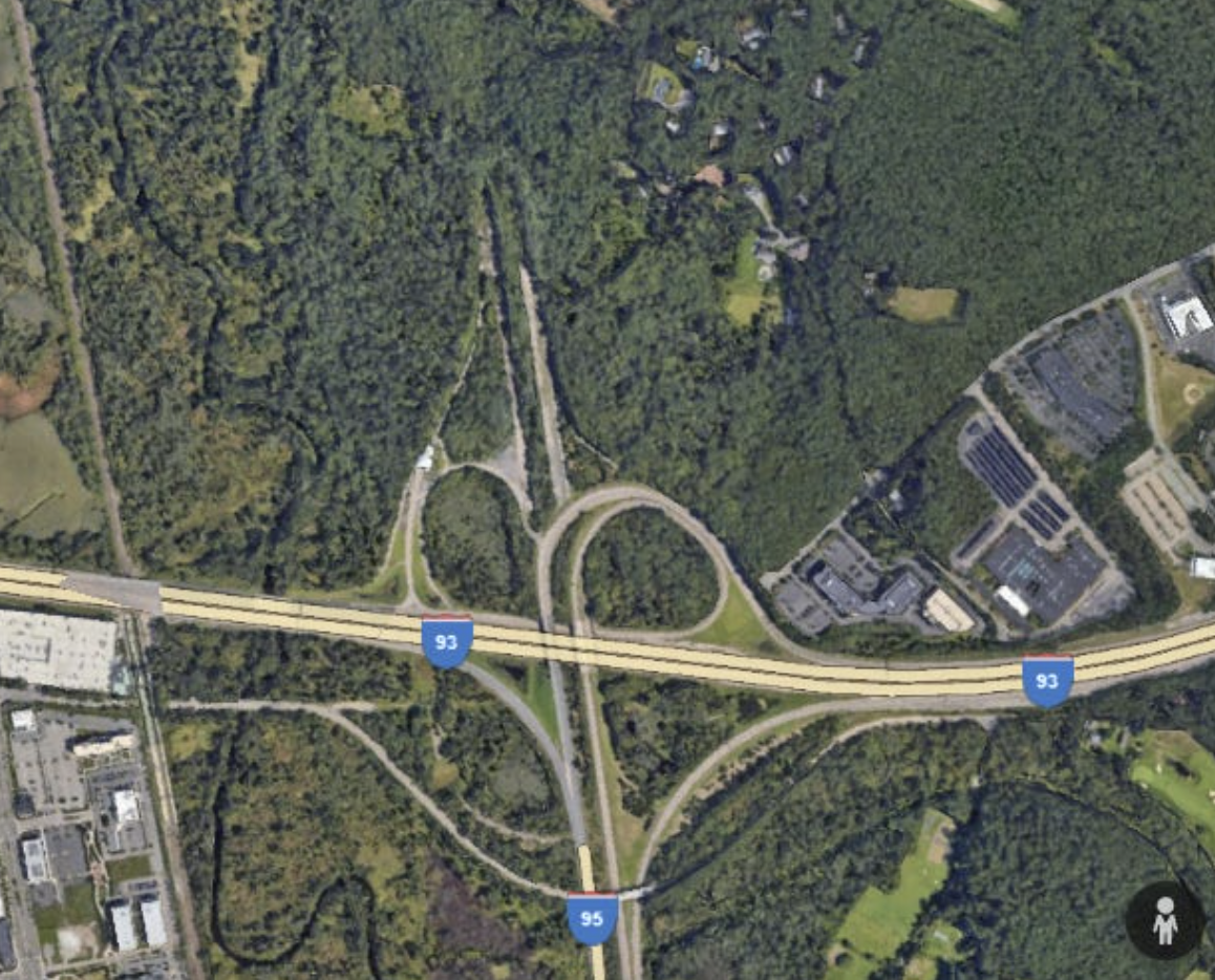
It sat right at the massive junction where Routes 93/128 meet 95, and it looked like it was meant to be a continuation of Route 95. So I dove into the history of this mystery pavement, learned everything I could, and checked to make sure I could access it legally.
What I found was one of the strangest (and coolest) abandoned infrastructure relics in Massachusetts:
The Abandoned Southwest Expressway. And YES—you can legally explore part of it.
What Was the Southwest Expressway?
TL;DR: An eight-lane highway planned to run from Canton to Boston… but never built.
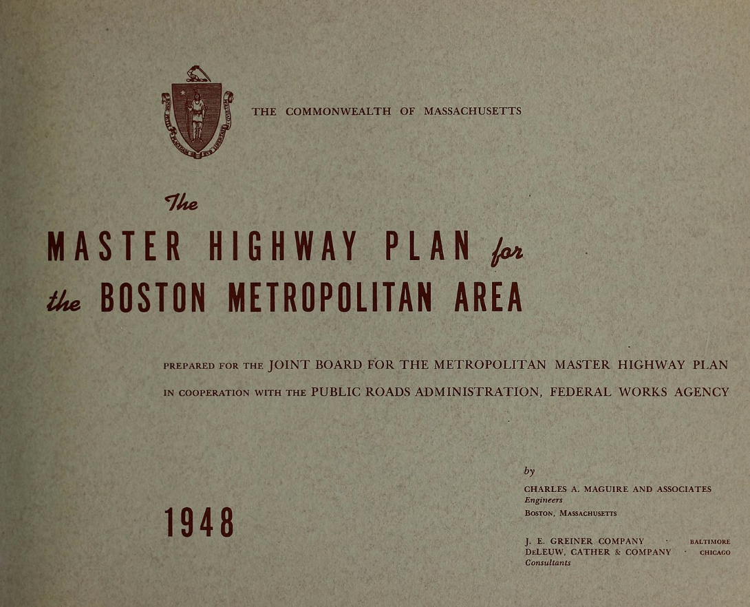
In 1948, Massachusetts Public Works director William F. Callahan released his massive Master Highway Plan for Metropolitan Boston. It proposed eight radial expressways all feeding into a belt route (I-695) around the city. The idea was to reduce congestion and improve safety, and Callahan hoped to build all of it within ten years.
The Southwest Expressway was to be one of those major routes. It would roughly follow the old Penn Central / New Haven Railroad mainline (today’s Amtrak Northeast Corridor) and cut through Milton, Hyde Park, Jamaica Plain, Roxbury, and the South End, eventually connecting with the proposed I-695 near modern-day Ruggles Station.
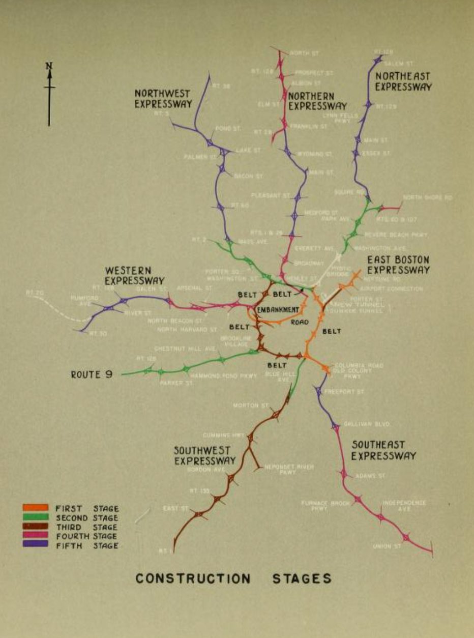
The plan also included a 50-foot median for an MBTA Orange Line extension running down the middle. It was an enormous and ambitious project…
And it never opened.
Why Was It Never Completed?
Construction began on various segments of Callahan’s highways, and six of the eight were eventually built. But two— the Northeast Expressway and the Southwest Expressway—fell apart during construction.
The biggest issues with the Southwest Expressway were:
1. It cut directly through dense, established neighborhoods
Starting in 1966, the state cleared over 500 homes and businesses between Forest Hills and the South End—displacing primarily lower-income and multiracial communities who largely didn’t even own cars. Meanwhile, the road was meant to help suburban commuters reach Boston more easily.
People took notice—and they fought back.
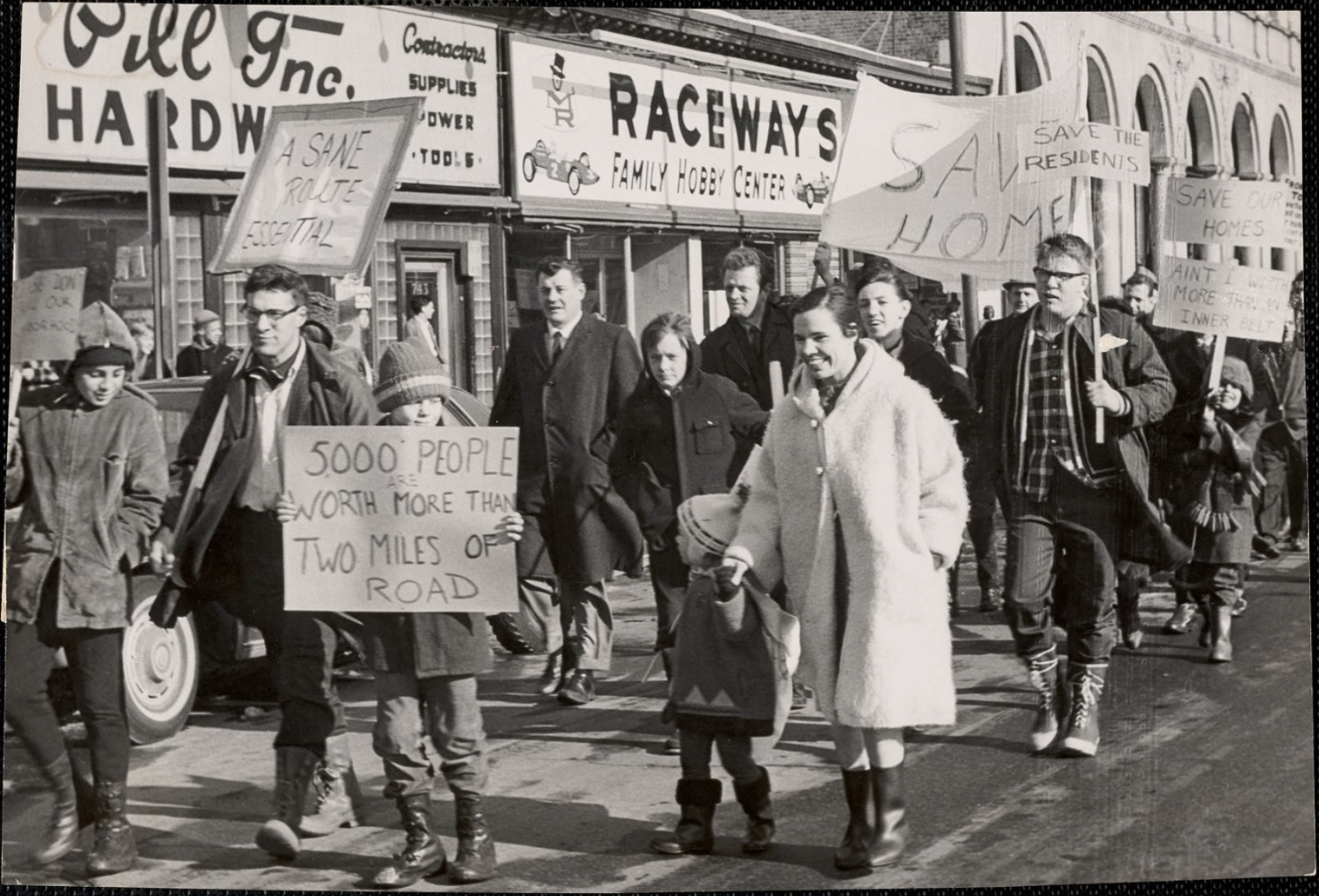
2. Communities organized and resisted
Roxbury - The Black United Front issued demands to halt construction immediately, arguing that the project would “radically affect the lives” of local residents.
Jamaica Plain - Neighbors formed the JP Expressway Committee, attended hearings, wrote letters, and spread the now-famous slogan:
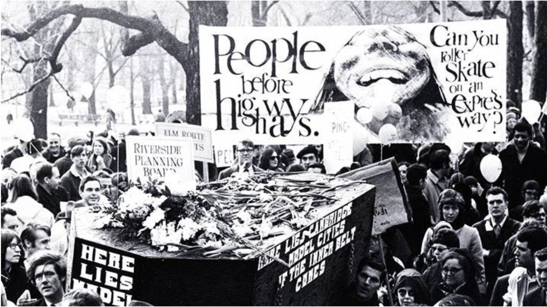
“People Before Highways.”
The movement grew into a citywide cause, eventually leading to People Before Highways Day at the Massachusetts State House on January 25, 1969, where more than 2,000 people protested. Even the son of newly inaugurated Governor Francis W. Sargent attended.
3. Governor Sargent hit the brakes
Sargent became governor just three days before the rally, and the public pressure clearly made an impact.
In 1970, he issued a moratorium on highway construction inside Route 128 and ordered a full re-evaluation of the expressway plan. The Boston Transportation Planning Review—led by Alan A. Altshuler—ultimately concluded that the 1940s/50s highway plans were obsolete and inappropriate for the 1970s and beyond.
In 1972, Sargent officially terminated the Southwest Expressway.
The funds originally intended for highway construction were rerouted to public transit, leading to MBTA improvements and the Orange Line corridor we know today.
What Remains Today?
1. Southwest Corridor Park
The cleared land in Boston that once held 500 families now forms the linear park and transitway stretching from Back Bay to Forest Hills.
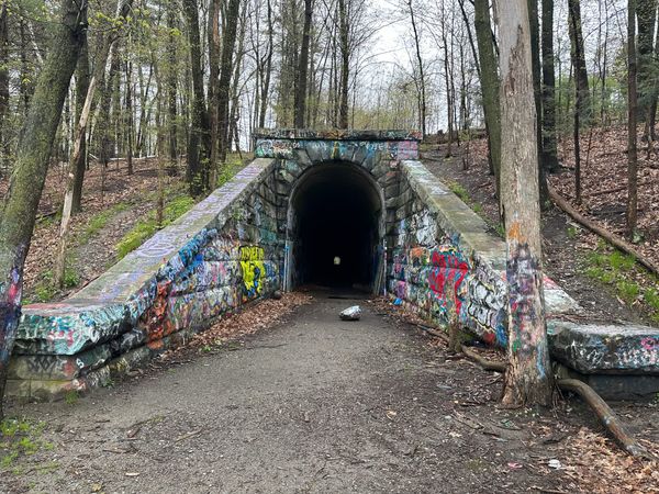
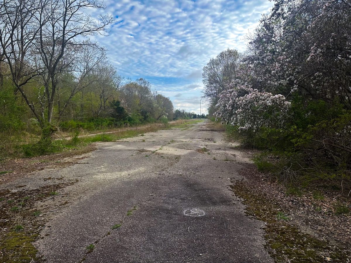
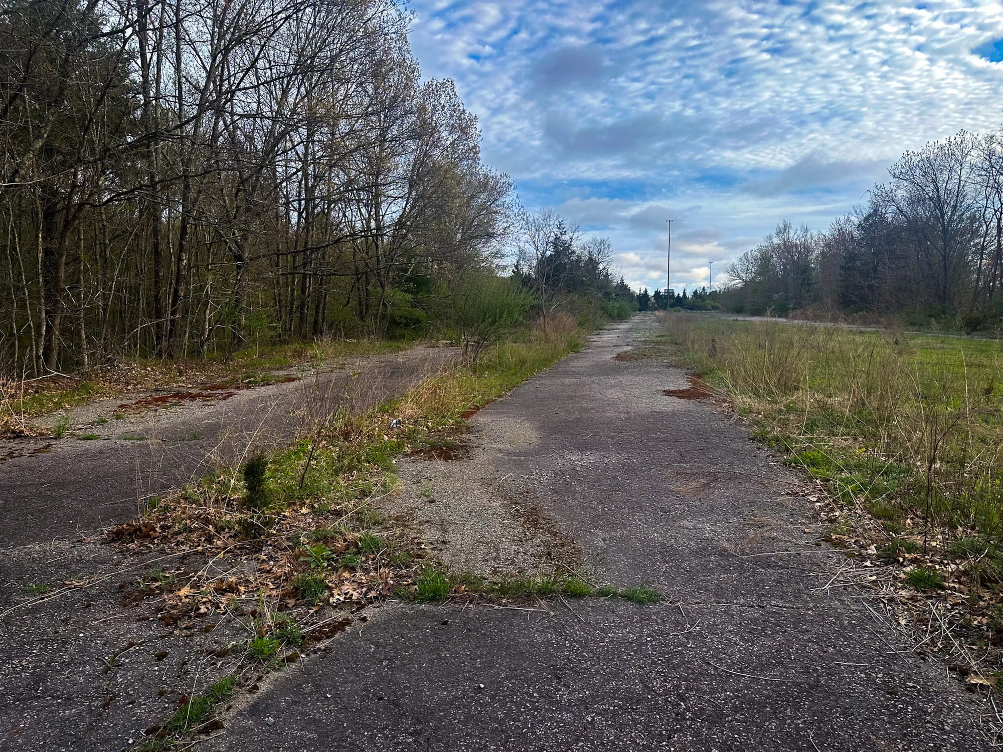
2. The abandoned highway at the 128/93/95 interchange
Before the project was cancelled, this portion of the massive interchange in Canton was nearly finished.
Today, hidden in the Blue Hills Reservation, you can find:
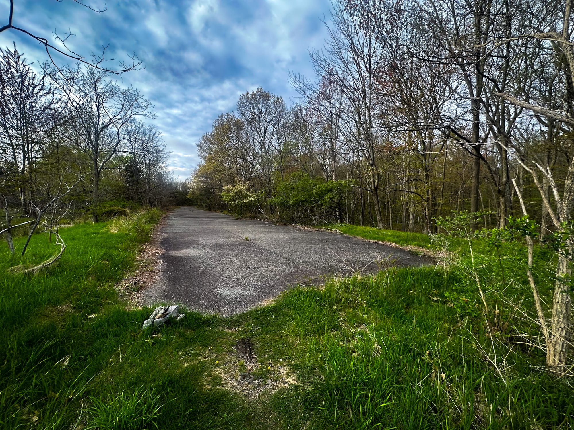
- Four abandoned highway lanes (northbound)
- Four abandoned lanes (southbound)
- Two ghost ramps
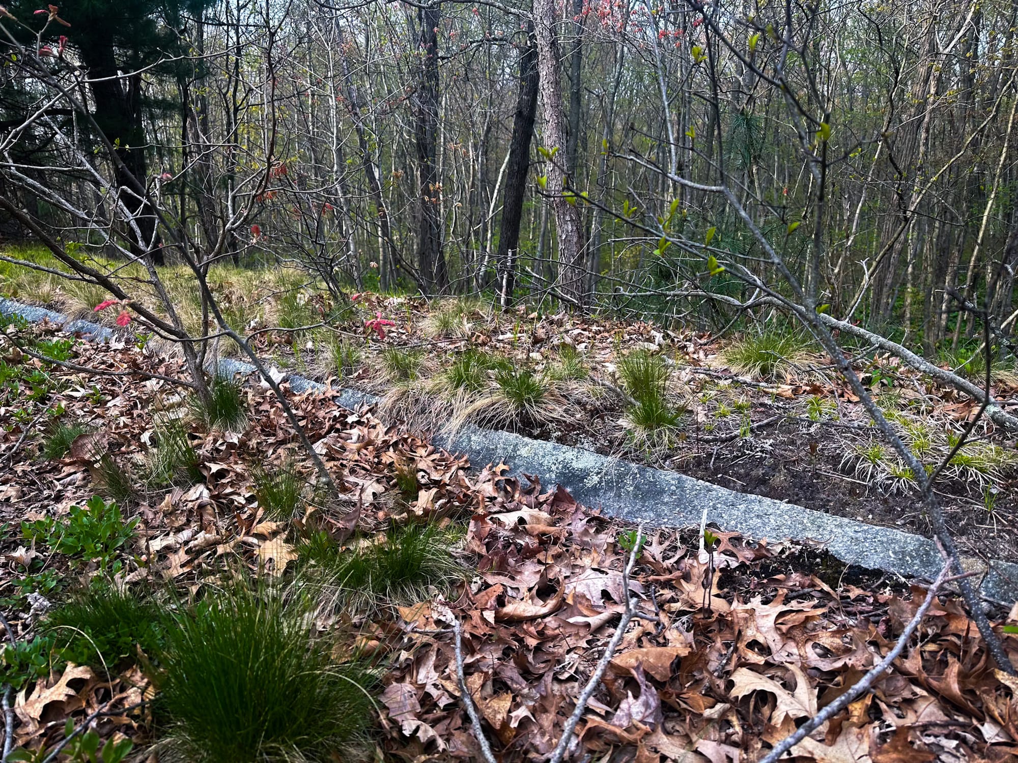
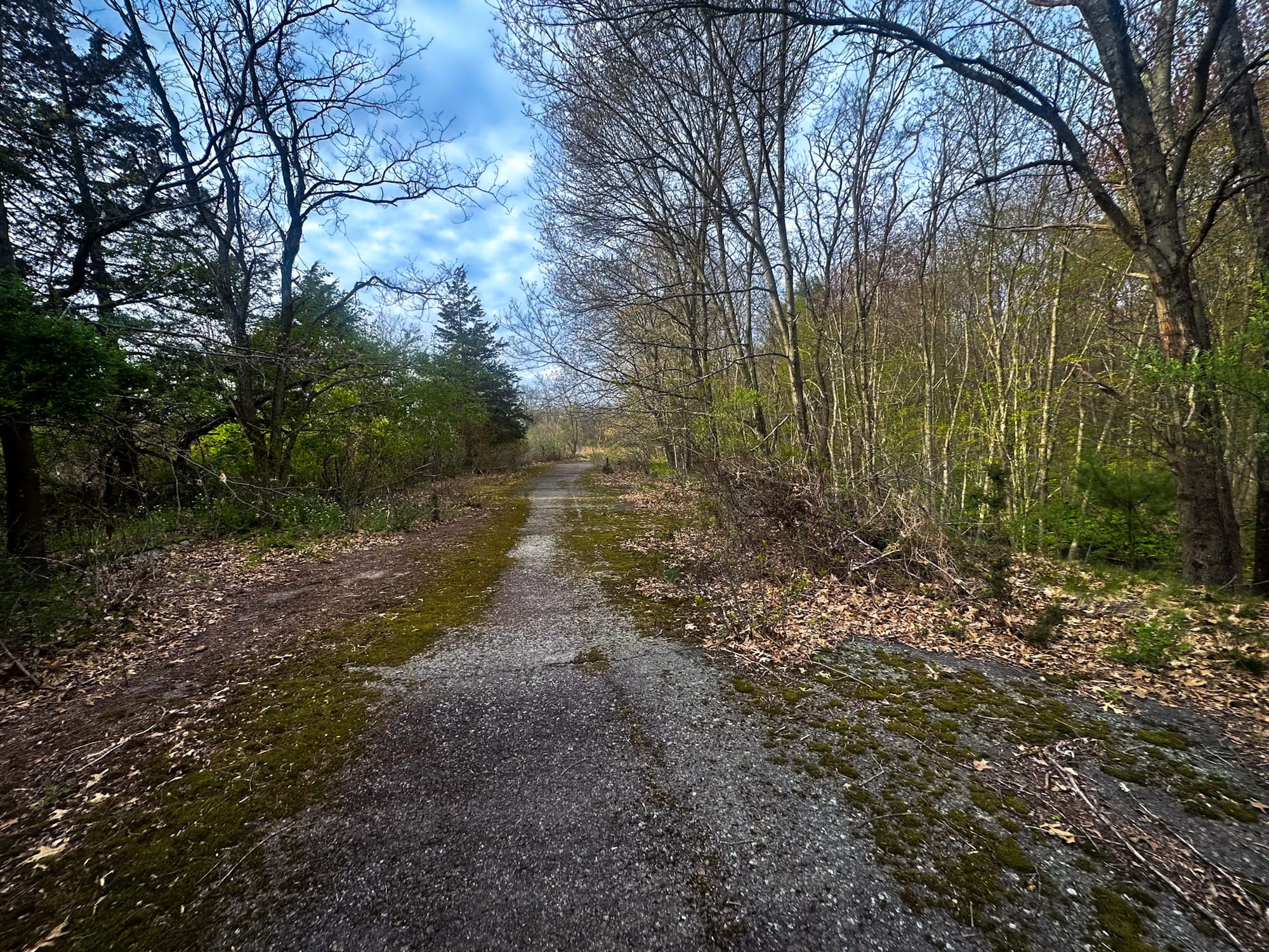
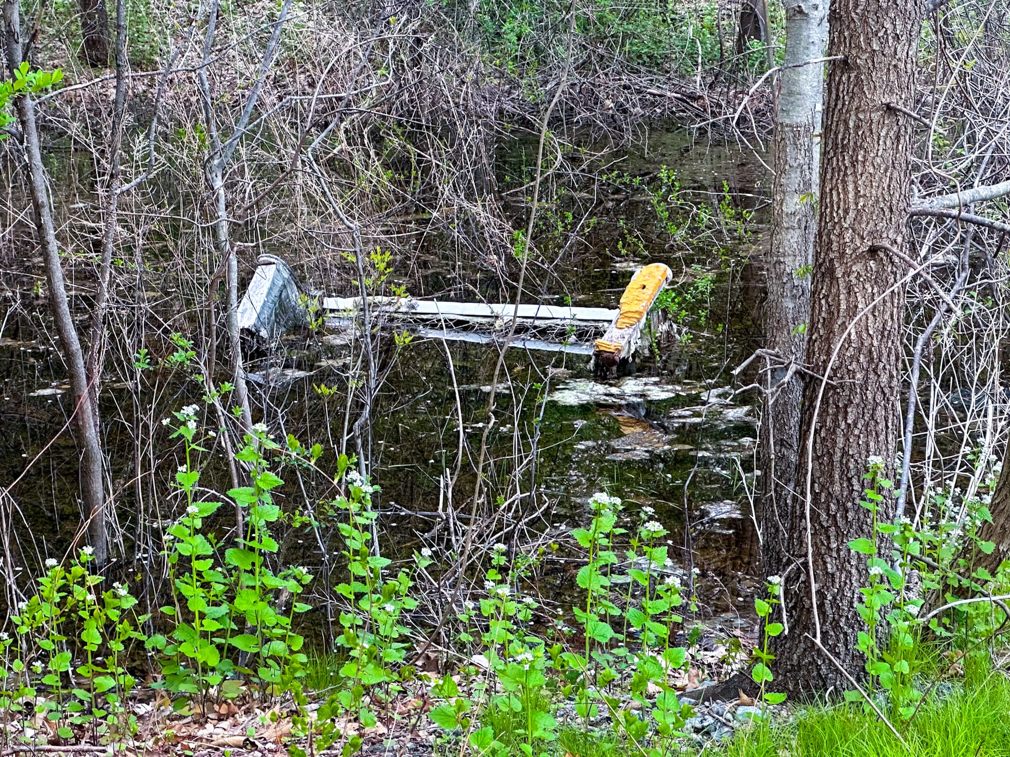
- Granite curbs, storm drains, and full highway-grade shoulders
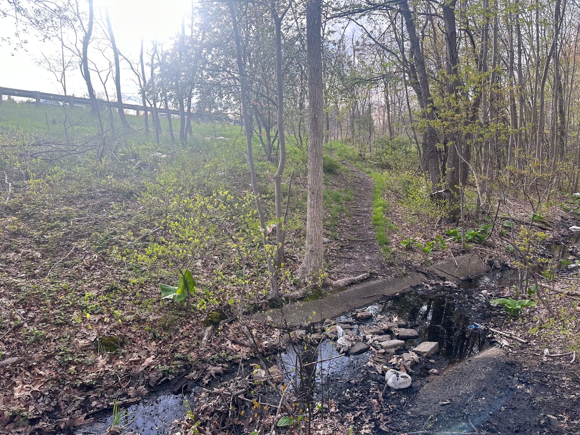
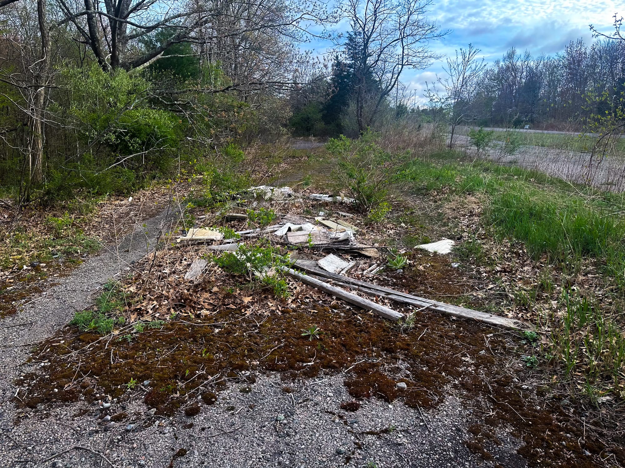
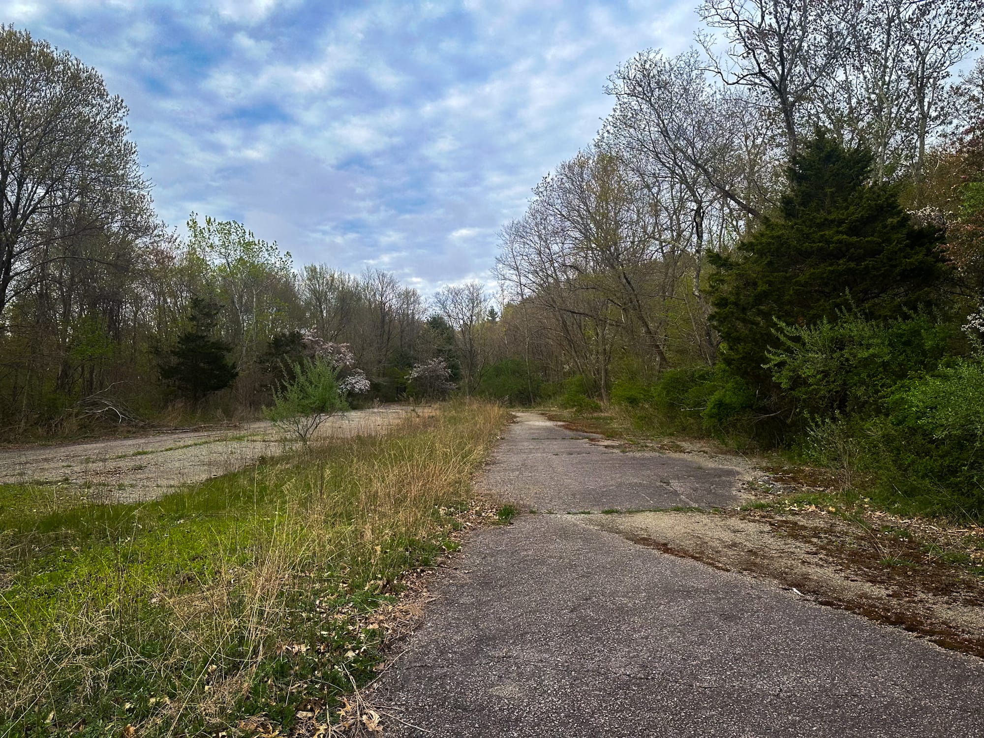
- Pavement being slowly swallowed by nature
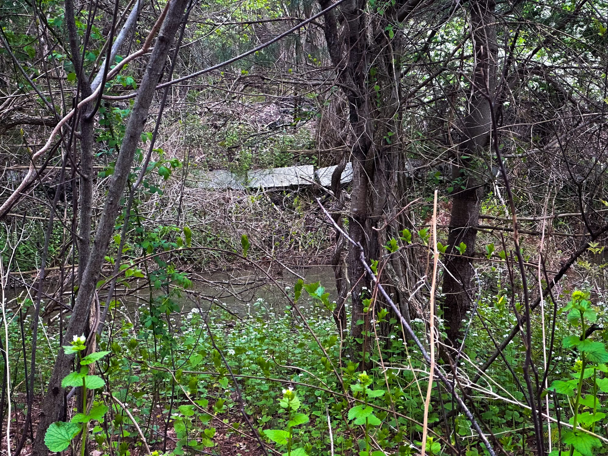
Two bridges for the expressway were built but later demolished after abandonment. Only the eastern lanes and one ramp are open to the public as part of the Blue Hills trail network. The western lanes are used by the state for vehicle storage and are strictly off-limits—do not trespass.
How to Access the Abandoned Highway (Legally)
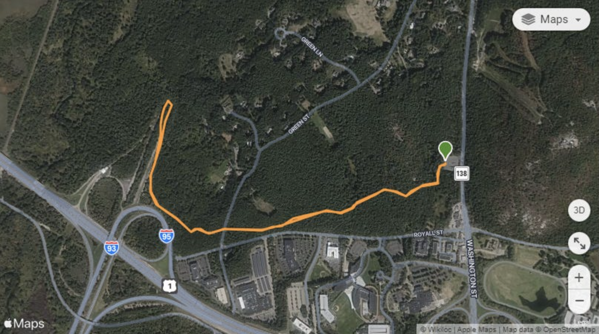
The expressway remains sit inside the Blue Hills Reservation, and the approach is easy and well-marked.
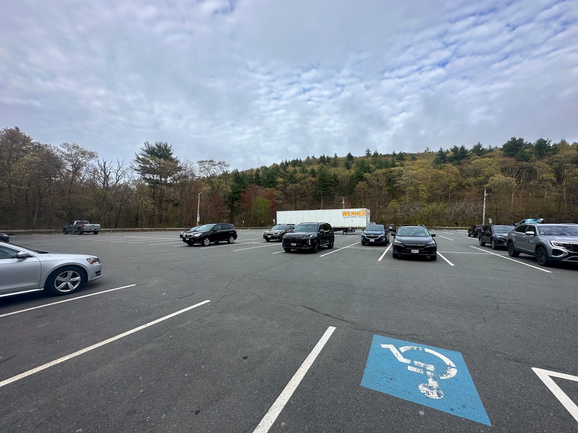
Parking
📍 2991 Washington Street, Canton, MA
Coordinates: 42.211028, -71.120500
Free parking in a paved lot.
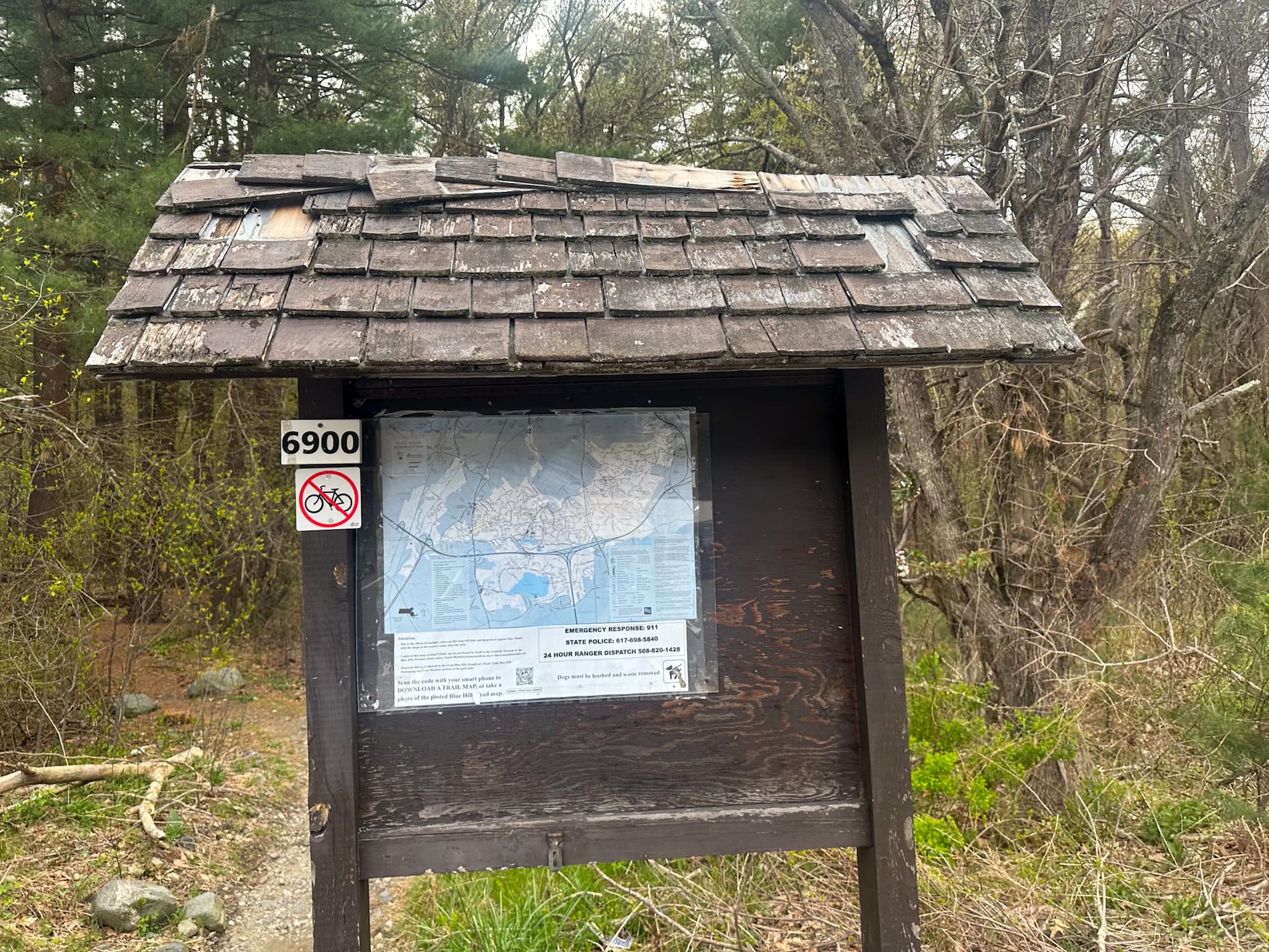
Trailhead
Look for the kiosk for updates and trail info.
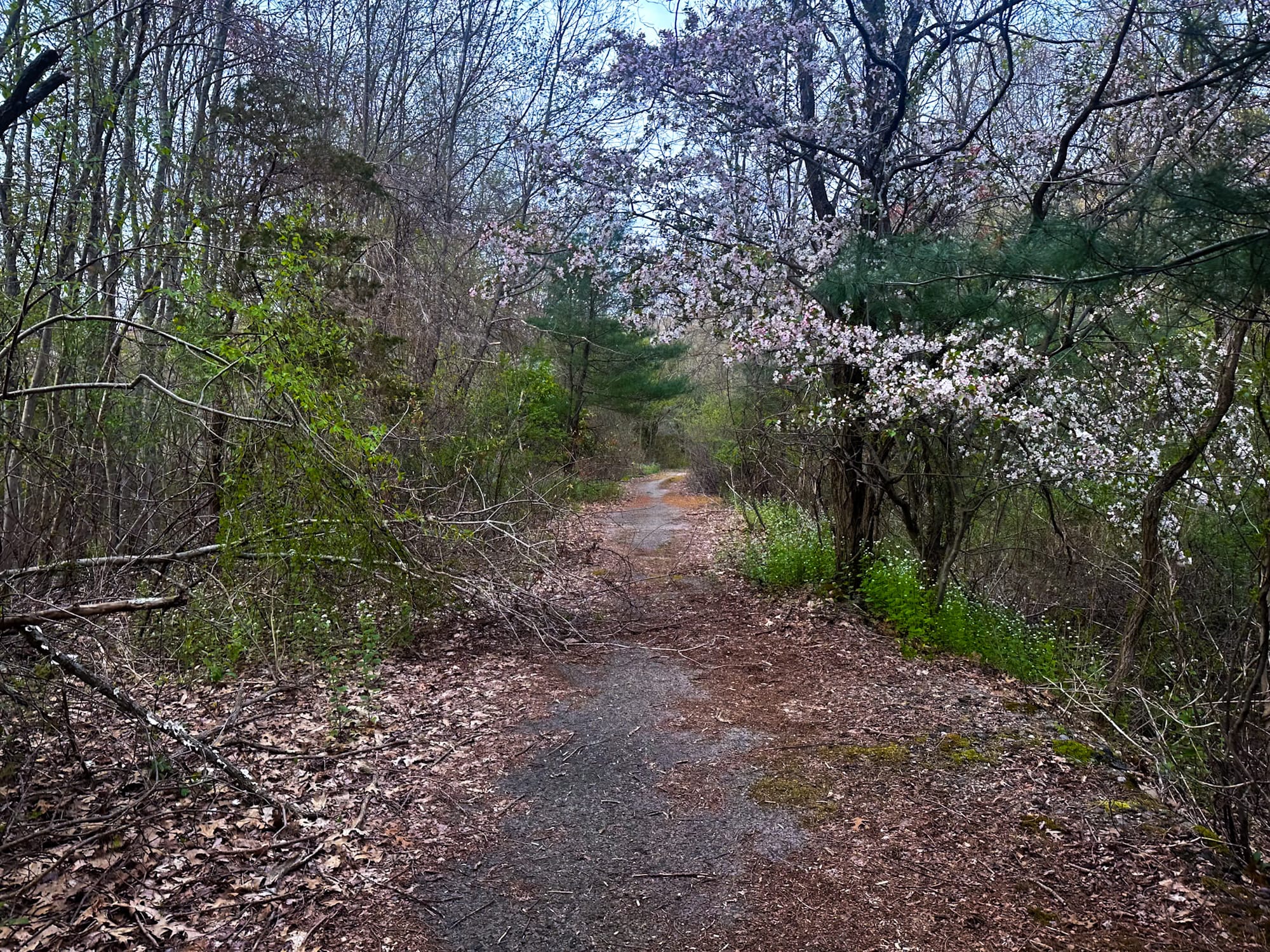
Hop onto the Skyline Trail, marked with blue blazes and numbered trees.
You’ll pass trees numbered:
6896 → 6891 → 6800 → 6700 → 6600
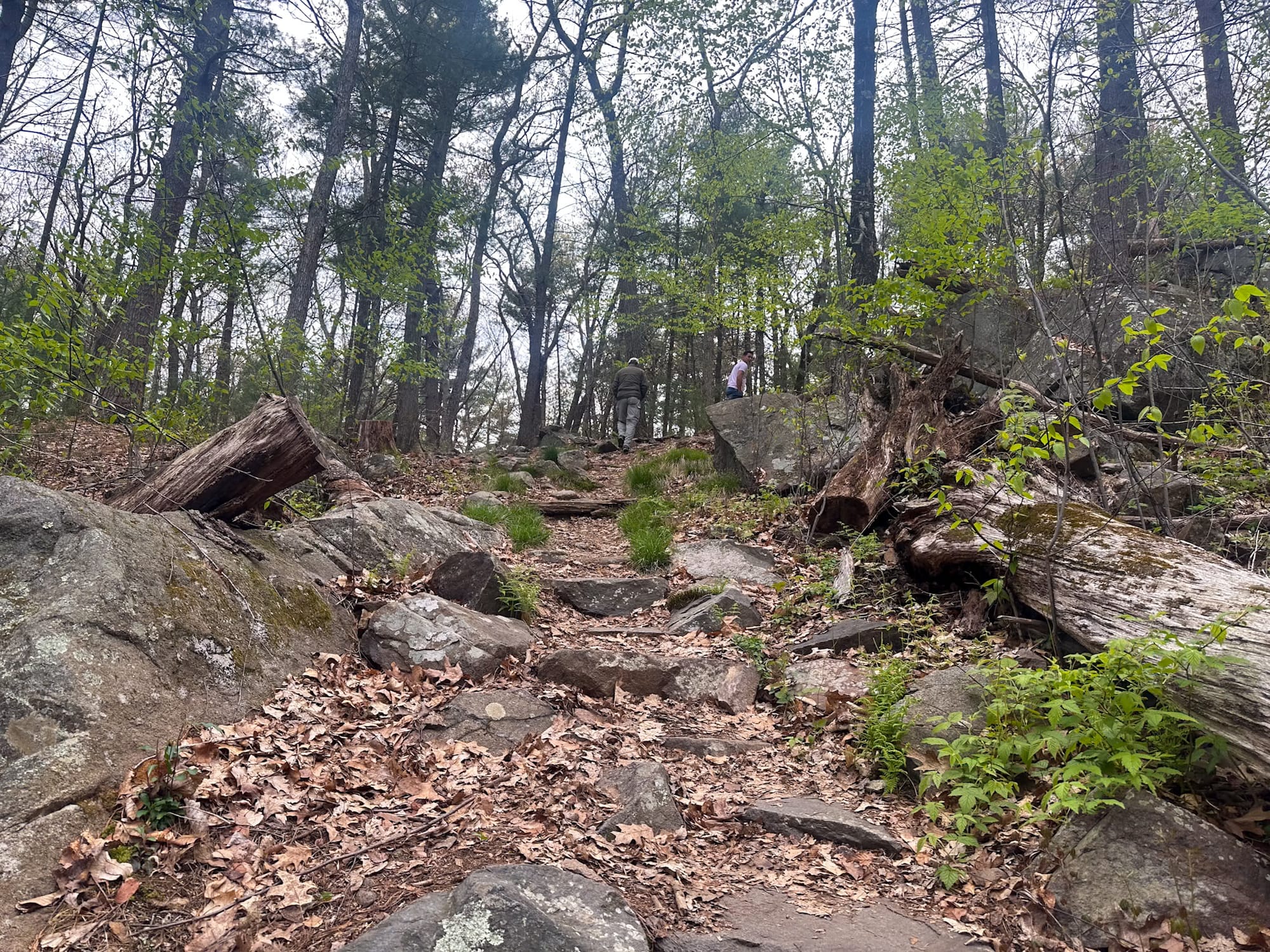
Trail Stats
- Distance: 2.6 miles out and back
- Elevation Gain: 217 ft
- Difficulty: Easy
- My Map: https://www.wikiloc.com/hiking-trails/southwest-expressway-171477995
The eastern ramp of the abandoned highway sits almost exactly 1 mile from the parking lot. It took me 20 minutes to reach it, 20 to explore, and 20 to return.
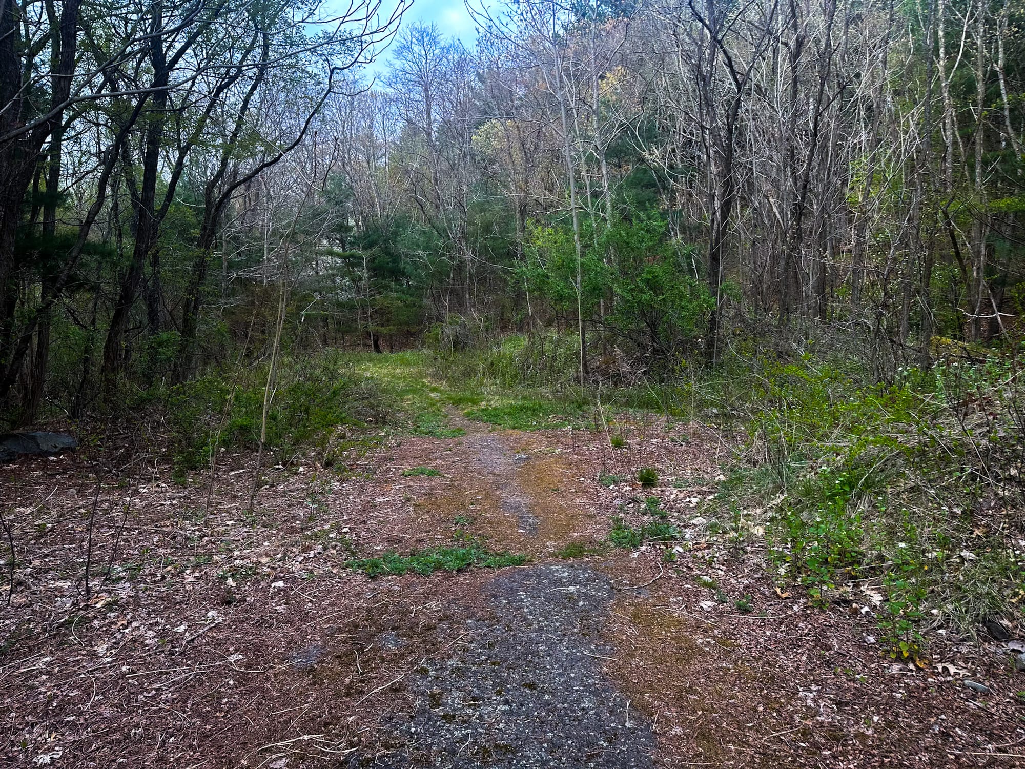
Exploring the Abandoned Highway
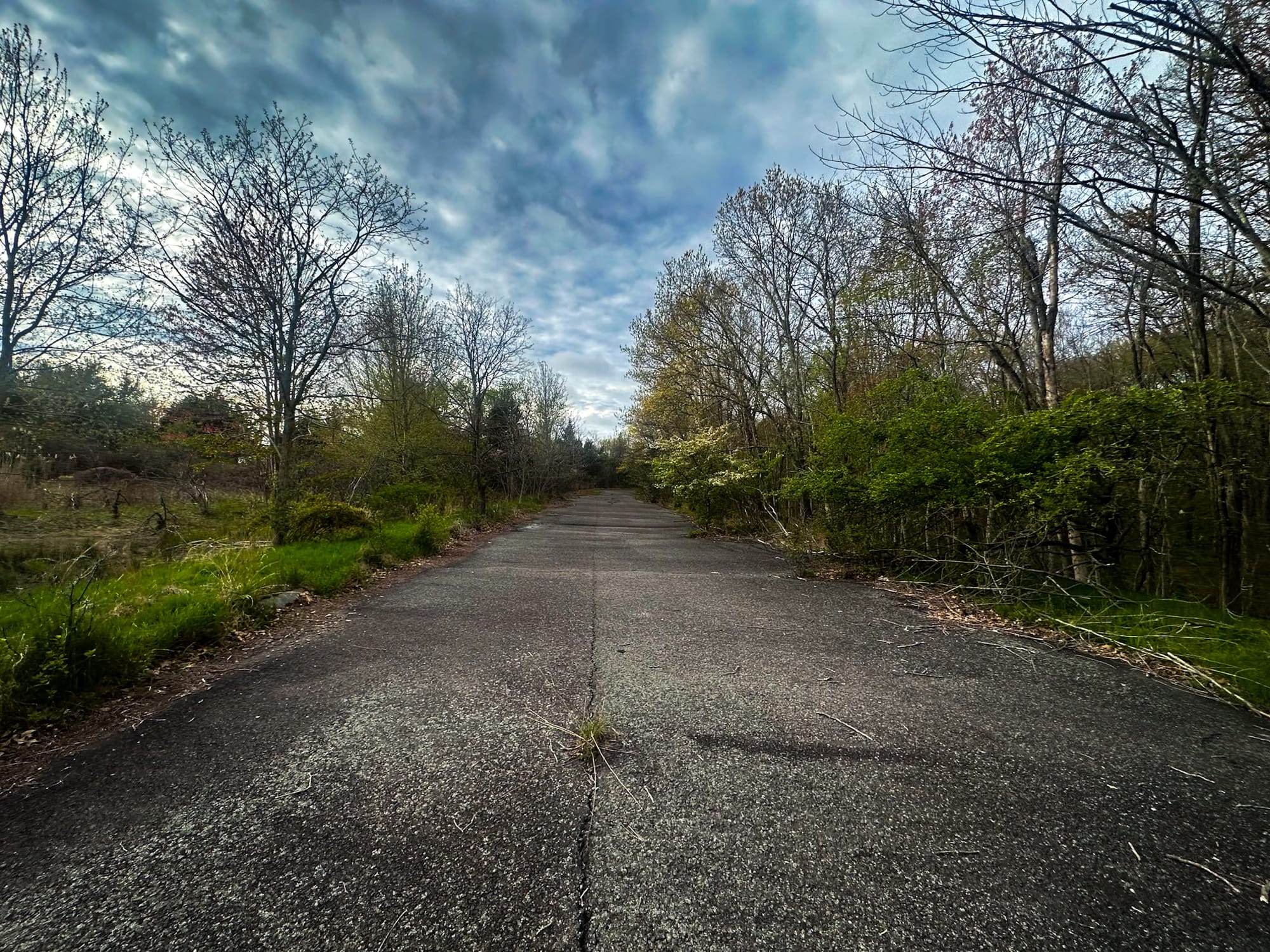
Walking up the eastern ramp is surreal. You're steps away from an active I-95 ramp, so the sound of cars is constant—but you're on a ghost highway with zero traffic.
As you move along:
- Granite curbs appear on both sides
- Original drains line the shoulders
- A full four-lane stretch of highway suddenly opens before you
- On one end: an active freeway ramp
- On the other: dense forest swallowing the pavement
It feels like something out of a post-apocalyptic movie.
The asphalt is cracked and buckled with trees breaking through. Grass fills old seams. Yet there’s almost no graffiti—just the slow, quiet takeover of nature.
There are no traffic lines either. Maybe they faded over time, or maybe the highway was abandoned before striping was applied. Either way, it adds to the eerie, unfinished feel.
As abandoned infrastructure goes, this one is clean, accessible, safe, and genuinely fascinating—especially if you’re into lost highways, failed megaprojects, or Boston history.
Final Notes
Only the eastern lanes and ramp are open to the public as part of DCR’s trail system.
The western lanes are state property used for storage—often actively. Do not trespass.
Coordinates
📍 Highway Location: 42.209917, -71.138639
📍 Parking: 42.211028, -71.120500