East Point Indicator Loop Station (Nahant, MA)
The East Point Indicator Loop Station in Nahant, Massachusetts, is a remarkable yet little-known relic of World War II coastal defense.

Perched on the rugged northeastern cliffs of East Point in Nahant, Massachusetts, the East Point Indicator Loop Station is a remarkable yet little-known relic of World War II coastal defense. Officially designated Indicator Loop Station 1D, it played a vital role in the protection of Boston Harbor from German submarines prowling the Atlantic.
Today, the ruins of the Operations Building and Power Building still cling to the windswept shoreline — stark, weathered reminders of a time when these cliffs were part of a sophisticated, secret military network designed to detect and destroy enemy submarines before they could approach the harbor.
Establishing the East Point Indicator Loop Station
The East Point Indicator Loop Station was established in 1942, as the United States ramped up its coastal defenses following its entry into World War II. It formed part of a highly classified underwater detection system that stretched along the New England coast, including additional stations in Scituate, Massachusetts, and Casco Bay, Maine.
Indicator loops were an ingenious early form of anti-submarine detection technology. First developed by the Royal Navy in the early 1900s and refined during World War I, they consisted of long, armored electrical cables laid across the seafloor. When a submarine — made of ferromagnetic metal — passed over a loop, the change in magnetic field would induce a small current, alerting operators to its presence.
The system’s location and operation were kept top-secret. Even many servicemen tasked with maintaining the equipment believed the cables were simply communications lines.
The U.S. Army Signal Corps and the Navy collaborated closely to establish these systems, and much of the cable was produced by the Simplex Wire and Cable Company in Portsmouth, New Hampshire — which manufactured over 3,000 miles of cable for the U.S. military during the war.
At East Point, two indicator loops were deployed — Loop 3 and Loop 4. Loop 3 stretched roughly 3 miles offshore, with a 4.5-mile tail cable connecting it back to the Operations Building. Loop 4 began directly near the station and extended 4.5 miles into the ocean. Together, they monitored the North Channel of Massachusetts Bay, supported by a nearby minefield to intercept any submarines that evaded detection.

The Naval Operations Building
Constructed from reinforced concrete and steel, the Operations Building was modest in size — roughly 20 feet long and 15 feet wide — but packed with specialized equipment. Inside, operators monitored readings from the loops using sono-radio buoy receivers, transmitter control boxes, and signal amplifiers, along with practical gear such as a binocular shelf, telescope, and communication equipment.
The building was manned around the clock, staffed by small naval teams trained to interpret the subtle electrical signals coming in from the seafloor cables. The station was equipped with simple amenities — a heater, water cooler, cabinets, and a fire extinguisher — but was largely functional and unadorned.
After the war’s end in 1945, the East Point Indicator Loop Station was decommissioned and quietly abandoned.

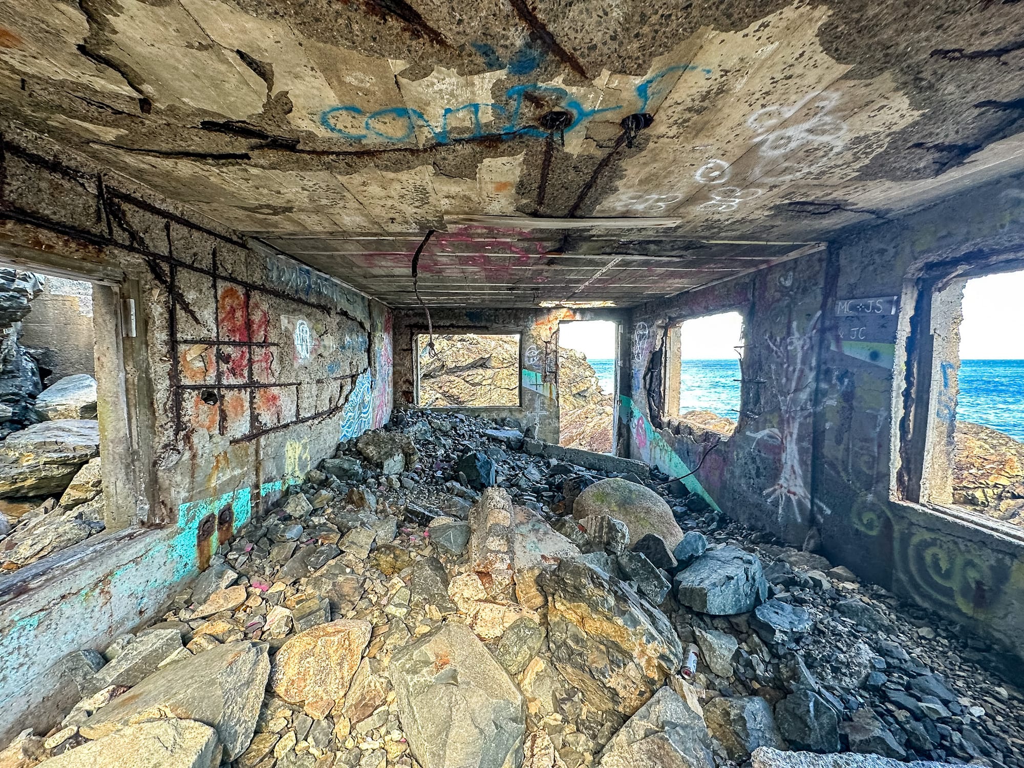
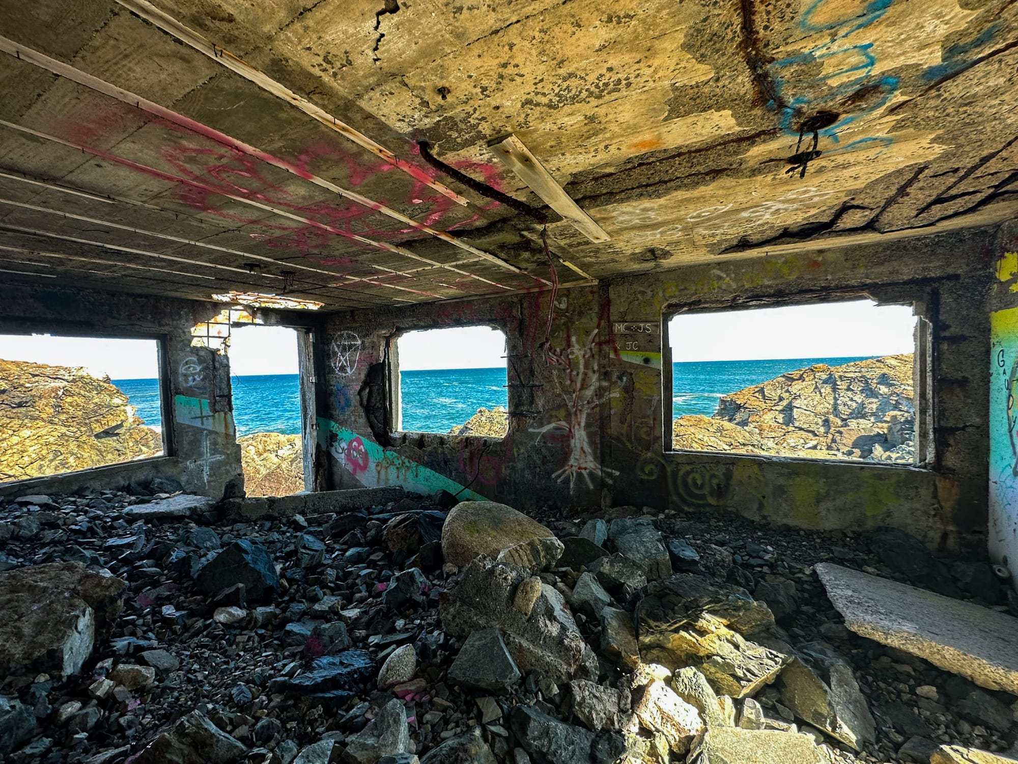
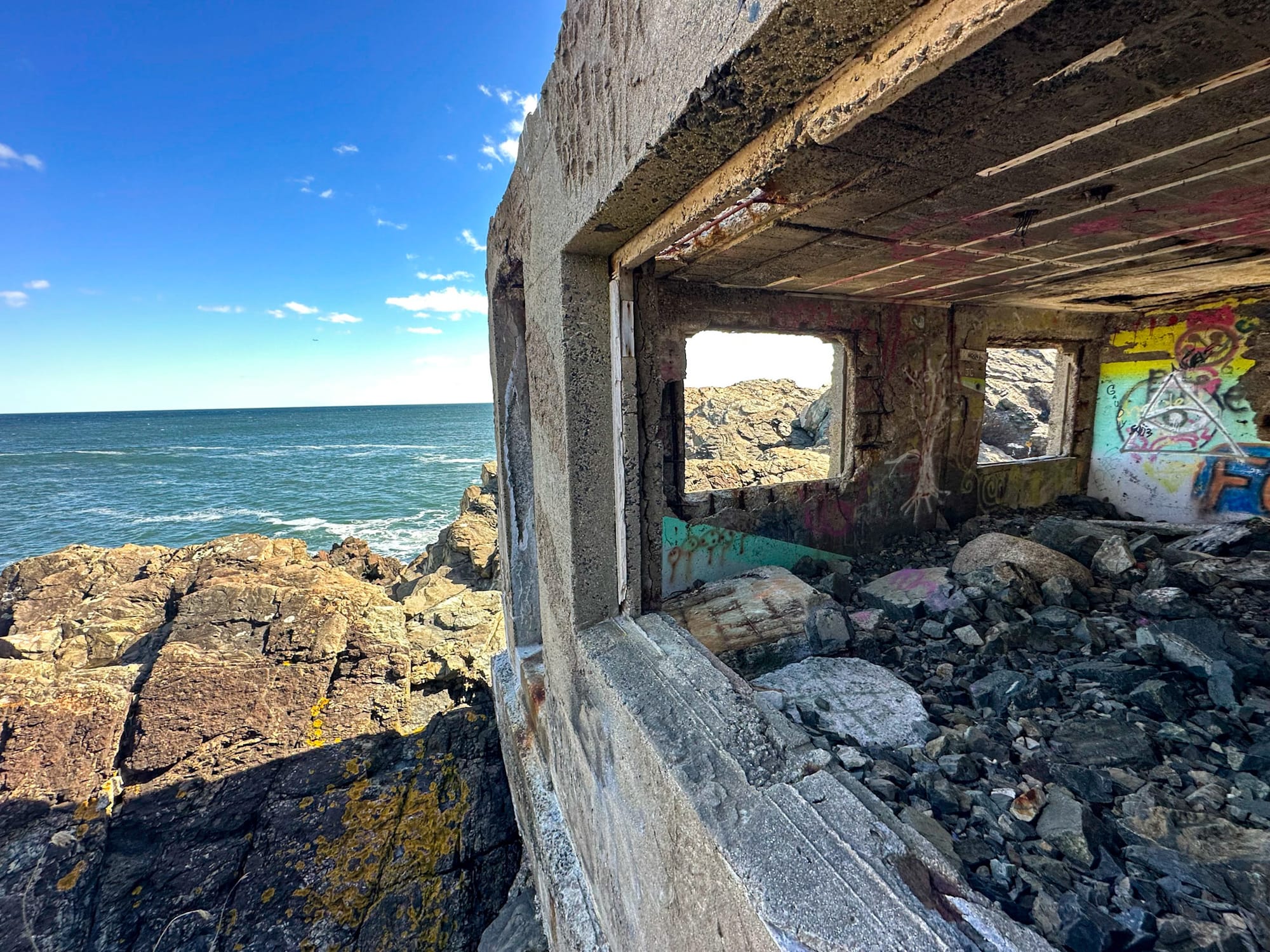
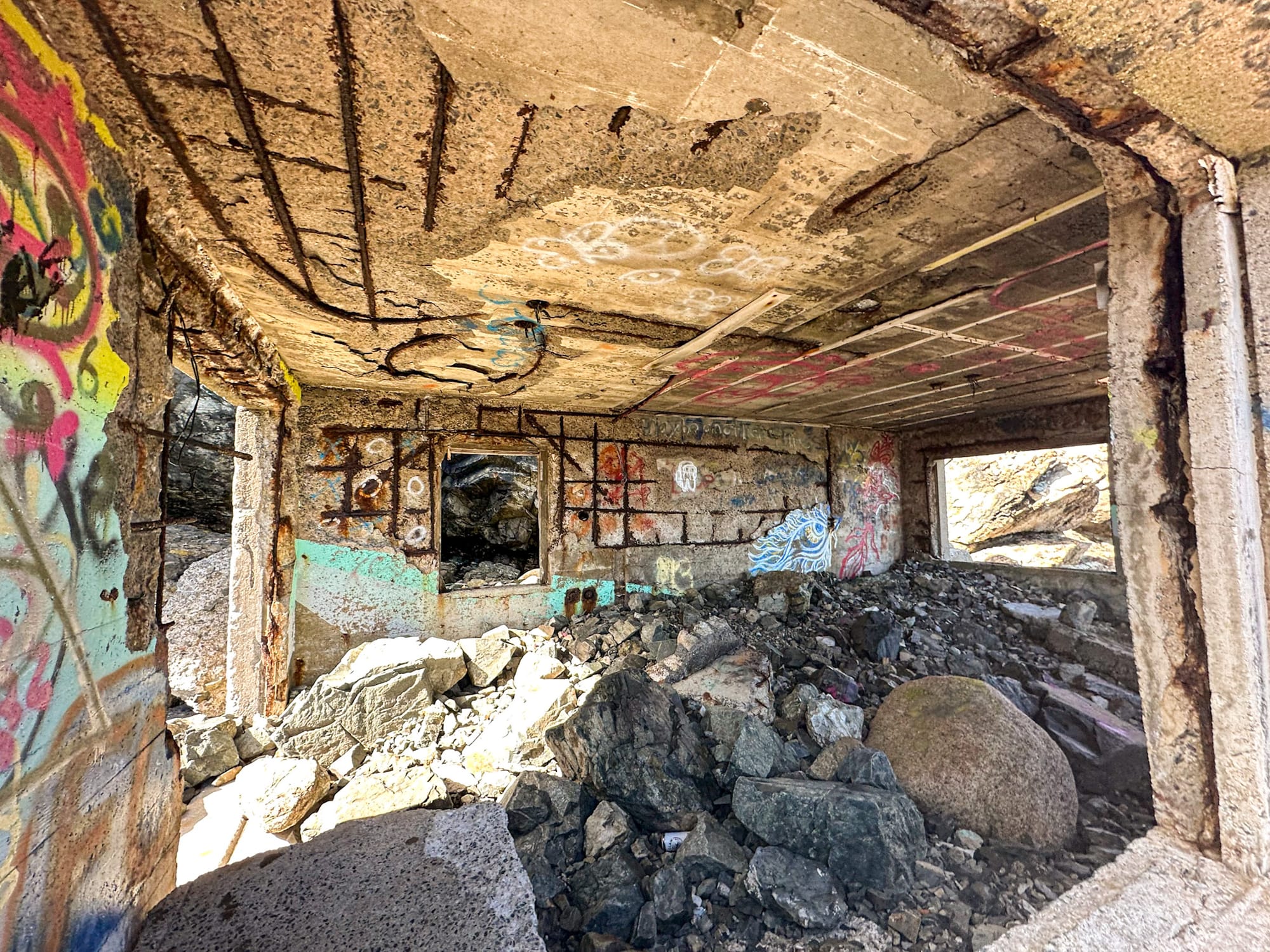
What Remains of the Operations Building Today
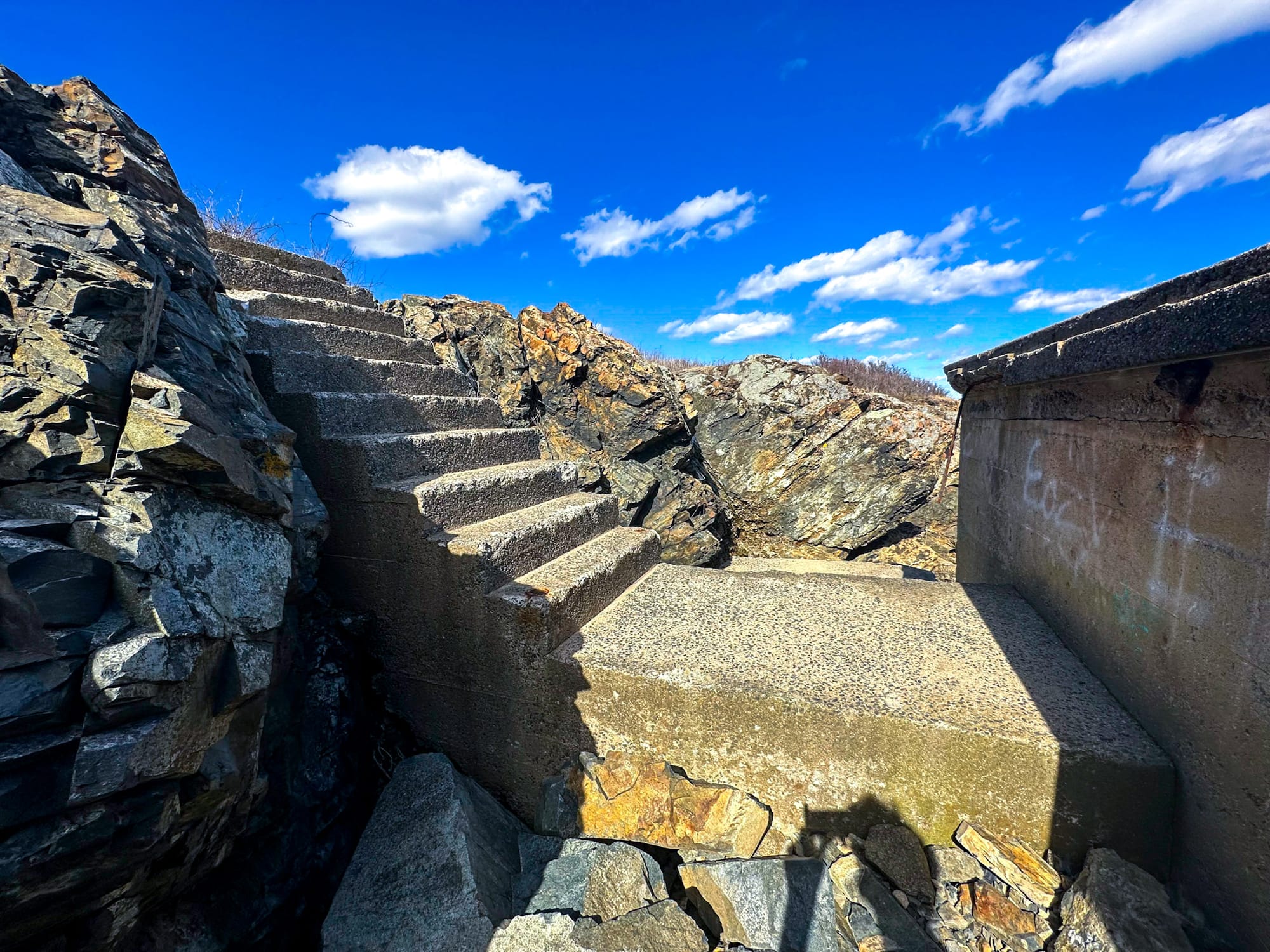
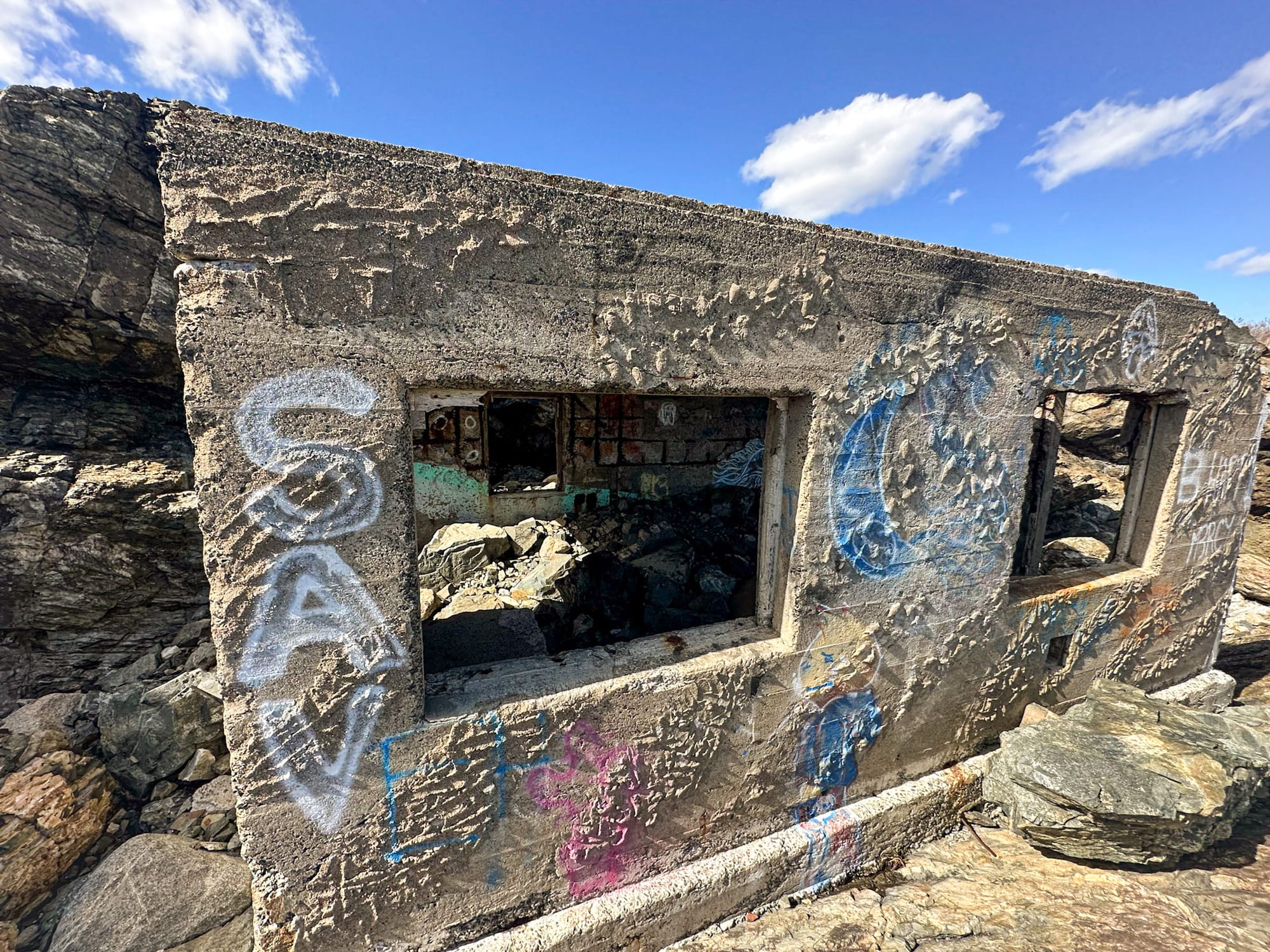
Today, the Operations Building still stands, its concrete walls battered by decades of salt, wind, and spray. The structure overlooks the Atlantic, standing defiantly above the crashing waves.
Visitors can see its doorway, window frames, and the circular openings at its base where the indicator cables once ran to the ocean floor. The interior is empty, but the walls still bear the scars of rusted steel reinforcements and decades of erosion.
The building’s isolation and proximity to the cliffs make it one of the most atmospheric — and dangerous — abandoned sites in Massachusetts. Visitors are urged to exercise extreme caution; the cliffs are unstable, and the surfaces are often slick with sea mist.
The Naval Administration and Power Building
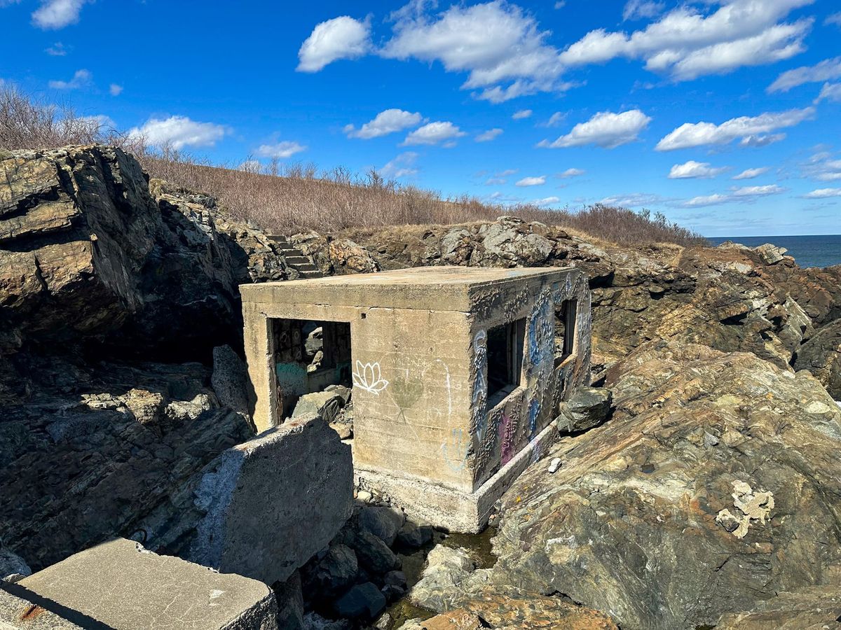
About 250 feet southwest of the Operations Building lies the Naval Administration and Power Building, partially embedded in the rocky shoreline. Completed on July 17, 1942, this two-room facility provided electricity and living quarters for the small crew stationed at East Point.
The administration room, measuring roughly 12 feet square, was outfitted with practical comforts — chairs, desks, typewriters, telephones, bunk beds with privacy curtains, a small refrigerator, stove, and coffee maker.
Next door, the power room housed a gasoline-powered generator rated at 12.5–15 kVA, capable of providing 110 volts of electricity to the Operations Building. The generator had an automatic transfer switch that could shift to emergency power instantly if the main line failed — an essential feature for wartime operations.
The entire building was heated by a small oil-burning furnace, with radiators fixed to the concrete floor.
What Remains of the Power Building Today
The Power Building still stands precariously near the edge of Cauldron Cliff, just above the roaring Atlantic. The concrete shell is heavily weathered, but several features remain visible — including remnants of stairs, door frames, and window openings.
Like its counterpart, the Power Building has endured 80 years of coastal storms and remains a remarkable artifact of World War II-era engineering.
The constant exposure to sea spray and wind has worn down the structure, but it continues to hold its form — a testament to the Navy’s construction standards during wartime.

Quick Facts
- 🏗 Established: 1942
- ⚓️ Decommissioned: 1946
- 💡 Purpose: Detection of submarines via seafloor indicator loops protecting Boston Harbor
- 🧱 Structures: Operations Building and Administration/Power Building
- 🌊 Loops Deployed: Loop 3 and Loop 4
- 🏭 Cable Manufacturer: Simplex Wire and Cable Company (Portsmouth, NH)
- 🔋 Power Output: 12.5–15 kVA generator, 110 volts
- 🧭 Location: East Point, Nahant, Massachusetts
Visiting the Site
- 📍 Address: Nahant Road, Nahant, Massachusetts
- 🌐 Operations Building GPS: 42.419014, –70.902682
- 🌐 Power Building GPS: 42.418452, –70.903302
- 🅿️ Parking Notes: Lodge Park has very limited parking — approximately five resident-only spaces at the entrance. Non-residents can park at the Nahant Public Library on Pleasant Street, which offers 30-minute free parking. From there, it’s a short but scenic walk along Nahant Road to East Point.
- ⚠️ Caution: Terrain is steep, rocky, and often slippery. Entering or climbing on the buildings is not advised due to instability and proximity to cliffs.
Final Thoughts
The East Point Indicator Loop Station is one of the most fascinating and overlooked remnants of World War II in Massachusetts. While other nearby installations like Battery Gardner and Battery Murphy focused on artillery defense, this site represented the cutting edge of electronic detection — a secret weapon against unseen underwater threats.
Though long abandoned, the two surviving concrete buildings continue to stand against the relentless forces of the Atlantic. They offer visitors a rare glimpse into a hidden chapter of coastal defense history — one where science, secrecy, and survival intersected on the edge of a New England cliff.
For history enthusiasts, photographers, and those drawn to forgotten wartime ruins, the East Point Indicator Loop Station remains one of the most hauntingly beautiful sites on the Massachusetts coast.