


About This Location
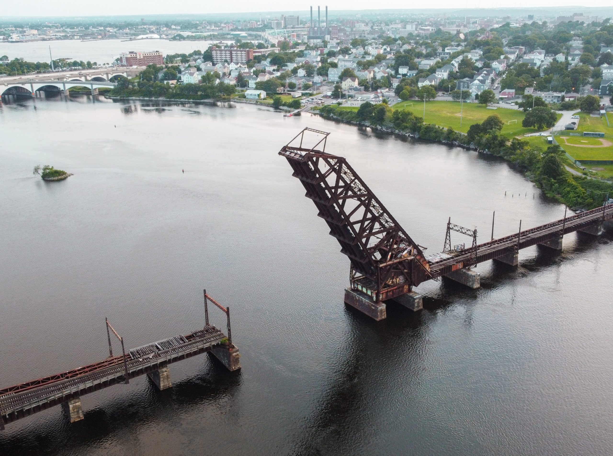
The Crook Point Bascule Bridge, standing as both a relic of the past and an urban icon of decay, is a fascinating abandoned structure in Providence, Rhode Island. This decommissioned Scherzer rolling lift railway bridge once connected Providence and East Providence, spanning the Seekonk River with a total length of 913 feet and a clear canal of 90 feet when opened to a distinctive 64-degree angle. Fondly referred to by locals as the "Always Up Bridge" or "Stuck-Up Bridge," it has become a symbol of urban history and abandonment, visible to thousands each day just north of the Washington Bridge.
Constructed in 1908 as part of the East Side Railroad Tunnel project, the bridge served to link the two cities. However, with the decline in railroad usage, the East Side Railroad Tunnel and the Seekonk River Drawbridge were decommissioned in 1976. The Crook Point Bascule Bridge remained in its open position to allow river traffic. In 1981, the Rhode Island Department of Transportation (RIDOT) acquired the bridge.
Since its abandonment, the bridge has become a haven for various enthusiasts, drawing photographers, artists, graffiti taggers, and architects. The bridge, with its rusty yet enduring metal framework, is situated just north of the Washington Bridge, which carries a major highway. A cycling route from an athletic field near Gano and Williams streets leads to the bridge's western entrance, providing easy access to its unique features.
Discussions about the bridge's future have been ongoing. In 2003, there was a proposal to convert the bridge and tunnel into a light rail system, but this idea was not pursued. In 2006, an advisory group explored potential uses, considering options such as a light rail or bus rapid transit system, ultimately deciding against them. The RIDOT initially announced plans for the bridge's demolition in 2018, scheduled for 2026-2027. However, in 2019, the city of Providence expressed interest in taking ownership of the bridge to prevent its demolition. A design competition sponsored by the city resulted in a winning proposal unveiled in June 2021, advocating for the transformation of the bridge and its surroundings into a public park.
For visitors, convenient parking is available at the Gano Park Public Parking Lot, located a mere 100 yards from the bridge. Parking is free, providing easy access to this captivating piece of Rhode Island's industrial history.


